Millersburg elevation
Millersburg (Ohio, Holmes County), United States elevation is 272 meters and Millersburg elevation in feet is 892 ft above sea level [src 1]. Millersburg is a seat of a second-order administrative division (feature code) with elevation that is 7 meters (23 ft) smaller than average city elevation in United States.
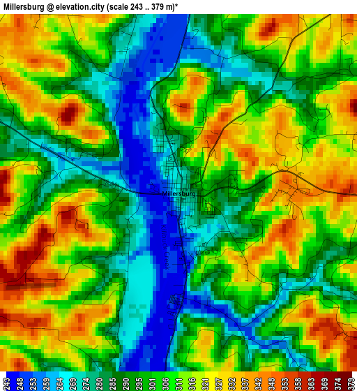
Below is the Elevation map of Millersburg, which displays elevation range with different colors. Scale of the first map is from 243 to 379 m (797 to 1243 ft) with average elevation of 302 meters (=991 ft) [note 1]
These maps also provides idea of topography and contour of this city, they are displayed at different zoom levels. More info about maps, scale and edge coordinates you can find below images.
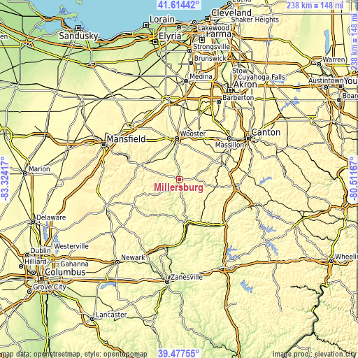
| \ | Map #1 | Topo.Map |
| Scale [m] | 243..379 m | × |
| Scale [ft] | 797..1243 ft | × |
| Average | 302 m = 991 ft | × |
| Width | 7.42 km = 4.6 mi | 237.6 km = 147.6 mi |
| Height | 7.43 km = 4.6 mi | 237.6 km = 147.6 mi |
| ↑Max Latitude | 40.587891° | 41.61442° |
| Latitude at center | 40.55451° | 40.55451° |
| ↓Min Latitude | 40.521113° | 39.47755° |
| ← Min Longitude | -81.961865° | -83.32417° |
| Longitude center | -81.91792° | -81.91792° |
| →Max Longitude | -81.873975° | -80.51167° |
Nearby cities:
Cities around Millersburg sort by population:
• Wooster elevation 303 m
27.9 km,  356°
356°
• Coshocton 234 m
31.8 km,  171°
171°
• Loudonville 297 m
28.1 km,  288°
288°
• Sugarcreek 305 m
24.1 km,  103°
103°
• Sugarcreek Police Dept 302 m
24 km, 103°
• Brewster 303 m
31.9 km,  57°
57°
• Dalton 333 m
33 km,  34°
34°
• Oak Hill 293 m
31.5 km,  240°
240°
• Shreve 274 m
16.6 km,  328°
328°
• Apple Creek 322 m
22.9 km,  16°
16°
• Danville 302 m
31.3 km,  247°
247°
• Beach City 310 m
30.5 km,  68°
68°
Multilingual:
 En español:
Millersburg elevación 272 m.
 En France:
Millersburg élévation 272 m.
 Auf Deutsch:
Millersburg höhe über dem Meeresspiegel ist 272 m.

Sources and notes:
- [note 1] Map square and city borders are not equal. Map elevation data is calculated only from area inside that square.
- [src 1] Elevation data from geonames database provided with same terms of usage.
- [src 2] The elevation map of Millersburg is generated using elevation data from NASA's 3 arcsec (90m) resolution SRTM data.
- [src 3] Base (background) map © OpenStreetMap contributors tiles are generated by Geofabrik and OpenTopoMap.
Copyright & License:
This Millersburg Elevation Map is licensed under CC BY-SA. You may reuse any part from this page, if you give a proper credit by linking to this URL:
 More info on terms of use page.