Burton elevation
Burton (Ohio, Geauga County), United States elevation is 405 meters and Burton elevation in feet is 1329 ft above sea level [src 1]. Burton is a populated place (feature code) with elevation that is 126 meters (413 ft) bigger than average city elevation in United States.
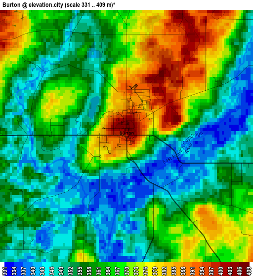
Below is the Elevation map of Burton, which displays elevation range with different colors. Scale of the first map is from 331 to 409 m (1086 to 1342 ft) with average elevation of 360.7 meters (=1183 ft) [note 1]
These maps also provides idea of topography and contour of this city, they are displayed at different zoom levels. More info about maps, scale and edge coordinates you can find below images.
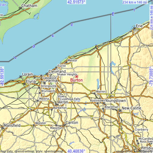
| \ | Map #1 | Topo.Map |
| Scale [m] | 331..409 m | × |
| Scale [ft] | 1086..1342 ft | × |
| Average | 360.7 m = 1183 ft | × |
| Width | 7.32 km = 4.5 mi | 234.3 km = 145.6 mi |
| Height | 7.32 km = 4.5 mi | 234.3 km = 145.6 mi |
| ↑Max Latitude | 41.50353° | 42.51573° |
| Latitude at center | 41.47061° | 41.47061° |
| ↓Min Latitude | 41.437674° | 40.40836° |
| ← Min Longitude | -81.189045° | -82.55135° |
| Longitude center | -81.1451° | -81.1451° |
| →Max Longitude | -81.101155° | -79.73885° |
Nearby cities:
Cities around Burton sort by population:
• Aurora elevation 342 m
23.8 km,  224°
224°
• Chardon 401 m
16 km,  358°
358°
• Chagrin Falls 302 m
20.5 km,  259°
259°
• South Russell 346 m
18.9 km, 256°
• Moreland Hills 319 m
23.7 km, 263°
• Bainbridge 358 m
18.7 km,  240°
240°
• Middlefield 341 m
6 km,  99°
99°
• Chesterland 375 m
17.1 km,  289°
289°
• Garrettsville 304 m
21.1 km,  168°
168°
• Gates Mills 222 m
22.1 km,  283°
283°
• Hiram 384 m
17.6 km,  179°
179°
• Mantua 355 m
21.8 km,  197°
197°
Multilingual:
 En español:
Burton elevación 405 m.
 En France:
Burton élévation 405 m.


Sources and notes:
- [note 1] Map square and city borders are not equal. Map elevation data is calculated only from area inside that square.
- [src 1] Elevation data from geonames database provided with same terms of usage.
- [src 2] The elevation map of Burton is generated using elevation data from NASA's 3 arcsec (90m) resolution SRTM data.
- [src 3] Base (background) map © OpenStreetMap contributors tiles are generated by Geofabrik and OpenTopoMap.
Copyright & License:
This Burton Elevation Map is licensed under CC BY-SA. You may reuse any part from this page, if you give a proper credit by linking to this URL:
 More info on terms of use page.