Archbold elevation
Archbold (Ohio, Fulton County), United States elevation is 223 meters and Archbold elevation in feet is 732 ft above sea level [src 1]. Archbold is a populated place (feature code) with elevation that is 56 meters (184 ft) smaller than average city elevation in United States.
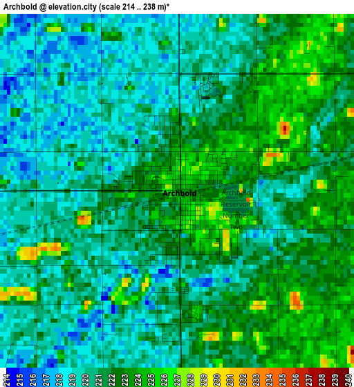
Below is the Elevation map of Archbold, which displays elevation range with different colors. Scale of the first map is from 214 to 238 m (702 to 781 ft) with average elevation of 220.9 meters (=725 ft) [note 1]
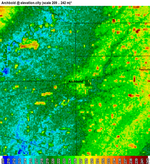
These maps also provides idea of topography and contour of this city, they are displayed at different zoom levels. More info about maps, scale and edge coordinates you can find below images.
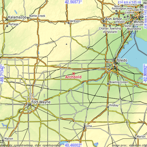
| \ | Map #1 | Map #2 | Topo.Map |
| Scale [m] | 214..238 m | 209..242 m | × |
| Scale [ft] | 702..781 ft | 686..794 ft | × |
| Average | 220.9 m = 725 ft | 221.2 m = 726 ft | × |
| Width | 7.32 km = 4.5 mi | 14.63 km = 9.1 mi | 234.1 km = 145.5 mi |
| Height | 7.32 km = 4.5 mi | 14.63 km = 9.1 mi | 234.1 km = 145.5 mi |
| ↑Max Latitude | 41.554334° | 41.587211° | 42.56573° |
| Latitude at center | 41.52144° | 41.52144° | 41.52144° |
| ↓Min Latitude | 41.488529° | 41.455602° | 40.46002° |
| ← Min Longitude | -84.351115° | -84.395061° | -85.71342° |
| Longitude center | -84.30717° | -84.30717° | -84.30717° |
| →Max Longitude | -84.263225° | -84.219279° | -82.90092° |
Nearby cities:
Cities around Archbold sort by population:
• Defiance elevation 206 m
26.7 km,  188°
188°
• Napoleon 208 m
20.9 km,  133°
133°
• Bryan 234 m
21.1 km,  255°
255°
• Wauseon 234 m
14.1 km,  77°
77°
• Montpelier 266 m
25.8 km,  285°
285°
• Delta 221 m
25.8 km, 76°
• Burlington 217 m
5.7 km,  359°
359°
• Morenci 234 m
23.2 km,  18°
18°
• West Unity 241 m
12.8 km,  304°
304°
• Stryker 217 m
9.1 km, 257°
• Fayette 240 m
17 km,  354°
354°
• Liberty Center 209 m
26.3 km,  109°
109°
Multilingual:
 En español:
Archbold elevación 223 m.
 En France:
Archbold élévation 223 m.
 Auf Deutsch:
Archbold höhe über dem Meeresspiegel ist 223 m.

Sources and notes:
- [note 1] Map square and city borders are not equal. Map elevation data is calculated only from area inside that square.
- [src 1] Elevation data from geonames database provided with same terms of usage.
- [src 2] The elevation map of Archbold is generated using elevation data from NASA's 3 arcsec (90m) resolution SRTM data.
- [src 3] Base (background) map © OpenStreetMap contributors tiles are generated by Geofabrik and OpenTopoMap.
Copyright & License:
This Archbold Elevation Map is licensed under CC BY-SA. You may reuse any part from this page, if you give a proper credit by linking to this URL:
 More info on terms of use page.