Lake Mohegan elevation
Lake Mohegan (New York, Westchester County), United States elevation is 161 meters and Lake Mohegan elevation in feet is 528 ft above sea level [src 1]. Lake Mohegan is a populated place (feature code) with elevation that is 118 meters (387 ft) smaller than average city elevation in United States.
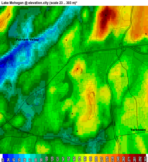
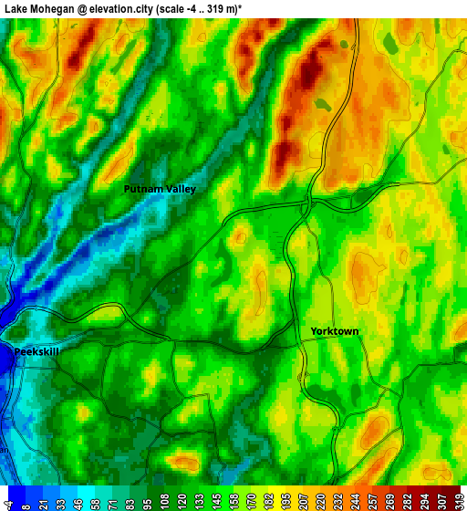
Below is the Elevation map of Lake Mohegan, which displays elevation range with different colors. Scale of the first map is from 23 to 303 m (75 to 994 ft) with average elevation of 142.2 meters (=467 ft) [note 1]
These maps also provides idea of topography and contour of this city, they are displayed at different zoom levels. More info about maps, scale and edge coordinates you can find below images.
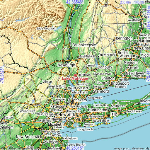
| \ | Map #1 | Map #2 | Topo.Map |
| Scale [m] | 23..303 m | -4..319 m | × |
| Scale [ft] | 75..994 ft | -13..1047 ft | × |
| Average | 142.2 m = 467 ft | 146.7 m = 481 ft | × |
| Width | 7.34 km = 4.6 mi | 14.68 km = 9.1 mi | 234.9 km = 146 mi |
| Height | 7.34 km = 4.6 mi | 14.68 km = 9.1 mi | 234.9 km = 146 mi |
| ↑Max Latitude | 41.350867° | 41.383848° | 42.36548° |
| Latitude at center | 41.31787° | 41.31787° | 41.31787° |
| ↓Min Latitude | 41.284856° | 41.251826° | 40.25315° |
| ← Min Longitude | -73.890195° | -73.934141° | -75.2525° |
| Longitude center | -73.84625° | -73.84625° | -73.84625° |
| →Max Longitude | -73.802305° | -73.758359° | -72.44° |
Nearby cities:
Cities around Lake Mohegan sort by population:
• Peekskill elevation 49 m
6.9 km,  243°
243°
• Jefferson Valley-Yorktown 202 m
3.8 km,  89°
89°
• Mahopac 212 m
11.2 km,  57°
57°
• Highland Falls 53 m
11.5 km,  299°
299°
• Montrose 37 m
10.2 km,  224°
224°
• Crompond 131 m
3 km,  212°
212°
• Buchanan 19 m
9.9 km,  231°
231°
• Shrub Oak 144 m
2.5 km, 64°
• Shenorock 160 m
9.2 km,  80°
80°
• Yorktown Heights 155 m
7.8 km,  132°
132°
• Crugers 32 m
11.4 km, 214°
• Lincolndale 116 m
10.7 km, 87°
Multilingual:
 En español:
Lake Mohegan elevación 161 m.
 En France:
Lake Mohegan élévation 161 m.
 Auf Deutsch:
Lake Mohegan höhe über dem Meeresspiegel ist 161 m.

Sources and notes:
- [note 1] Map square and city borders are not equal. Map elevation data is calculated only from area inside that square.
- [src 1] Elevation data from geonames database provided with same terms of usage.
- [src 2] The elevation map of Lake Mohegan is generated using elevation data from NASA's 3 arcsec (90m) resolution SRTM data.
- [src 3] Base (background) map © OpenStreetMap contributors tiles are generated by Geofabrik and OpenTopoMap.
Copyright & License:
This Lake Mohegan Elevation Map is licensed under CC BY-SA. You may reuse any part from this page, if you give a proper credit by linking to this URL:
 More info on terms of use page.