Flemington elevation
Flemington (New Jersey, Hunterdon County), United States elevation is 56 meters and Flemington elevation in feet is 184 ft above sea level [src 1]. Flemington is a seat of a second-order administrative division (feature code) with elevation that is 223 meters (732 ft) smaller than average city elevation in United States.
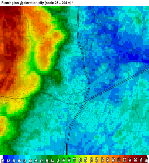
Below is the Elevation map of Flemington, which displays elevation range with different colors. Scale of the first map is from 25 to 204 m (82 to 669 ft) with average elevation of 78.6 meters (=258 ft) [note 1]
These maps also provides idea of topography and contour of this city, they are displayed at different zoom levels. More info about maps, scale and edge coordinates you can find below images.
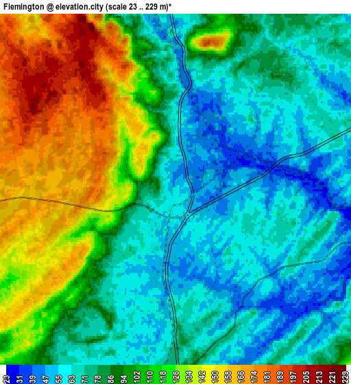
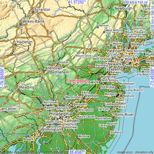
| \ | Map #1 | Map #2 | Topo.Map |
| Scale [m] | 25..204 m | 23..229 m | × |
| Scale [ft] | 82..669 ft | 75..751 ft | × |
| Average | 78.6 m = 258 ft | 94.2 m = 309 ft | × |
| Width | 7.43 km = 4.6 mi | 14.86 km = 9.2 mi | 237.7 km = 147.7 mi |
| Height | 7.43 km = 4.6 mi | 14.86 km = 9.2 mi | 237.7 km = 147.7 mi |
| ↑Max Latitude | 40.545732° | 40.579117° | 41.57292° |
| Latitude at center | 40.51233° | 40.51233° | 40.51233° |
| ↓Min Latitude | 40.478912° | 40.445476° | 39.4347° |
| ← Min Longitude | -74.903275° | -74.947221° | -76.26558° |
| Longitude center | -74.85933° | -74.85933° | -74.85933° |
| →Max Longitude | -74.815385° | -74.771439° | -73.45308° |
Nearby cities:
Cities around Flemington sort by population:
• Bradley Gardens elevation 24 m
18.2 km,  72°
72°
• Raritan 20 m
20.2 km, 71°
• Bloomingdale 29 m
18 km,  95°
95°
• Lambertville 28 m
17.7 km,  203°
203°
• High Bridge 99 m
17.5 km,  349°
349°
• Clinton 62 m
14.5 km,  342°
342°
• New Hope 26 m
18.2 km,  205°
205°
• Whitehouse Station 60 m
13.7 km,  33°
33°
• Hopewell 64 m
16 km,  148°
148°
• Annandale 97 m
14.4 km, 352°
• Lebanon 85 m
14.5 km,  7°
7°
• Frenchtown 42 m
17.2 km,  275°
275°
Multilingual:
 En español:
Flemington elevación 56 m.
 En France:
Flemington élévation 56 m.
 Auf Deutsch:
Flemington höhe über dem Meeresspiegel ist 56 m.

Sources and notes:
- [note 1] Map square and city borders are not equal. Map elevation data is calculated only from area inside that square.
- [src 1] Elevation data from geonames database provided with same terms of usage.
- [src 2] The elevation map of Flemington is generated using elevation data from NASA's 3 arcsec (90m) resolution SRTM data.
- [src 3] Base (background) map © OpenStreetMap contributors tiles are generated by Geofabrik and OpenTopoMap.
Copyright & License:
This Flemington Elevation Map is licensed under CC BY-SA. You may reuse any part from this page, if you give a proper credit by linking to this URL:
 More info on terms of use page.