Bloomingdale elevation
Bloomingdale (New Jersey, Somerset County), United States elevation is 29 meters and Bloomingdale elevation in feet is 95 ft above sea level [src 1]. Bloomingdale is a populated place (feature code) with elevation that is 250 meters (820 ft) smaller than average city elevation in United States.
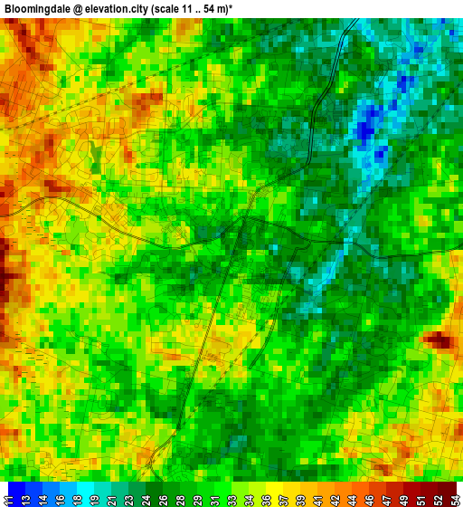
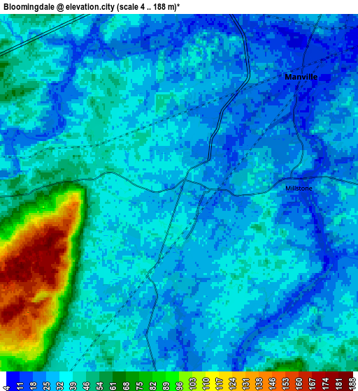
Below is the Elevation map of Bloomingdale, which displays elevation range with different colors. Scale of the first map is from 11 to 54 m (36 to 177 ft) with average elevation of 31.4 meters (=103 ft) [note 1]
These maps also provides idea of topography and contour of this city, they are displayed at different zoom levels. More info about maps, scale and edge coordinates you can find below images.
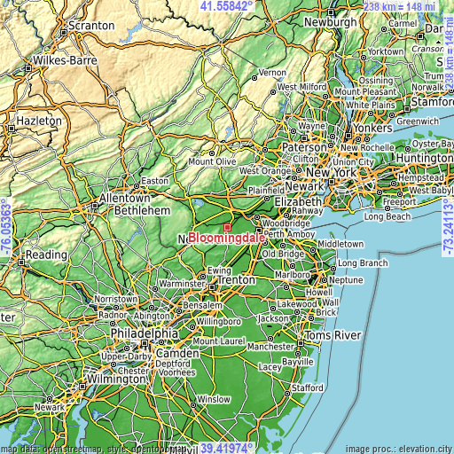
| \ | Map #1 | Map #2 | Topo.Map |
| Scale [m] | 11..54 m | 4..188 m | × |
| Scale [ft] | 36..177 ft | 13..617 ft | × |
| Average | 31.4 m = 103 ft | 39.2 m = 129 ft | × |
| Width | 7.43 km = 4.6 mi | 14.86 km = 9.2 mi | 237.8 km = 147.8 mi |
| Height | 7.43 km = 4.6 mi | 14.86 km = 9.2 mi | 237.8 km = 147.8 mi |
| ↑Max Latitude | 40.531009° | 40.564402° | 41.55842° |
| Latitude at center | 40.4976° | 40.4976° | 40.4976° |
| ↓Min Latitude | 40.464174° | 40.430732° | 39.41974° |
| ← Min Longitude | -74.691325° | -74.735271° | -76.05363° |
| Longitude center | -74.64738° | -74.64738° | -74.64738° |
| →Max Longitude | -74.603435° | -74.559489° | -73.24113° |
Nearby cities:
Cities around Bloomingdale sort by population:
• Bridgewater elevation 57 m
11.5 km,  359°
359°
• Bradley Gardens 24 m
7.3 km, 355°
• Franklin Park 42 m
11.5 km,  124°
124°
• Somerville 18 m
9.1 km,  20°
20°
• Manville 17 m
7 km,  46°
46°
• Kendall Park 58 m
11.2 km,  139°
139°
• Raritan 20 m
8.1 km,  8°
8°
• Finderne 27 m
9.4 km,  38°
38°
• Franklin Center 32 m
9.7 km,  67°
67°
• Middlebush 38 m
10 km,  90°
90°
• Ten Mile Run 98 m
10.2 km,  157°
157°
• Weston 14 m
6.4 km, 48°
Multilingual:
 En español:
Bloomingdale elevación 29 m.
 En France:
Bloomingdale élévation 29 m.
 Auf Deutsch:
Bloomingdale höhe über dem Meeresspiegel ist 29 m.

Sources and notes:
- [note 1] Map square and city borders are not equal. Map elevation data is calculated only from area inside that square.
- [src 1] Elevation data from geonames database provided with same terms of usage.
- [src 2] The elevation map of Bloomingdale is generated using elevation data from NASA's 3 arcsec (90m) resolution SRTM data.
- [src 3] Base (background) map © OpenStreetMap contributors tiles are generated by Geofabrik and OpenTopoMap.
Copyright & License:
This Bloomingdale Elevation Map is licensed under CC BY-SA. You may reuse any part from this page, if you give a proper credit by linking to this URL:
 More info on terms of use page.