Pelham elevation
Pelham (New Hampshire, Hillsborough County), United States elevation is 50 meters and Pelham elevation in feet is 164 ft above sea level [src 1]. Pelham is a populated place (feature code) with elevation that is 229 meters (751 ft) smaller than average city elevation in United States.
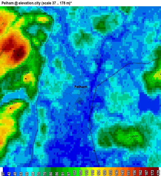
Below is the Elevation map of Pelham, which displays elevation range with different colors. Scale of the first map is from 37 to 178 m (121 to 584 ft) with average elevation of 66.5 meters (=218 ft) [note 1]
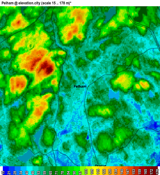
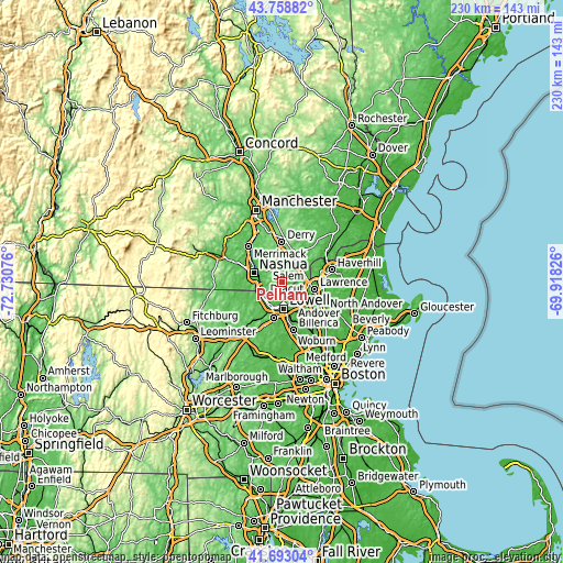
These maps also provides idea of topography and contour of this city, they are displayed at different zoom levels. More info about maps, scale and edge coordinates you can find below images.
| \ | Map #1 | Map #2 | Topo.Map |
| Scale [m] | 37..178 m | 15..178 m | × |
| Scale [ft] | 121..584 ft | 49..584 ft | × |
| Average | 66.5 m = 218 ft | 69.9 m = 229 ft | × |
| Width | 7.18 km = 4.5 mi | 14.36 km = 8.9 mi | 229.7 km = 142.7 mi |
| Height | 7.18 km = 4.5 mi | 14.36 km = 8.9 mi | 229.7 km = 142.7 mi |
| ↑Max Latitude | 42.7668° | 42.799053° | 43.75882° |
| Latitude at center | 42.73453° | 42.73453° | 42.73453° |
| ↓Min Latitude | 42.702244° | 42.66994° | 41.69304° |
| ← Min Longitude | -71.368455° | -71.412401° | -72.73076° |
| Longitude center | -71.32451° | -71.32451° | -71.32451° |
| →Max Longitude | -71.280565° | -71.236619° | -69.91826° |
Nearby cities:
Cities around Pelham sort by population:
• Lowell elevation 39 m
11.3 km,  176°
176°
• Nashua 52 m
12.2 km,  286°
286°
• Lawrence 20 m
13.5 km,  103°
103°
• Methuen 39 m
11 km,  94°
94°
• Chelmsford 88 m
15.4 km,  193°
193°
• Salem 43 m
11.7 km,  59°
59°
• Dracut 51 m
7.4 km,  165°
165°
• Windham 64 m
7.5 km,  12°
12°
• Tyngsboro 46 m
10.4 km,  231°
231°
• Londonderry 128 m
15.1 km,  344°
344°
• Hudson 50 m
10 km, 289°
• Dunstable 72 m
14.5 km,  242°
242°
Multilingual:
 En español:
Pelham elevación 50 m.
 En France:
Pelham élévation 50 m.


Sources and notes:
- [note 1] Map square and city borders are not equal. Map elevation data is calculated only from area inside that square.
- [src 1] Elevation data from geonames database provided with same terms of usage.
- [src 2] The elevation map of Pelham is generated using elevation data from NASA's 3 arcsec (90m) resolution SRTM data.
- [src 3] Base (background) map © OpenStreetMap contributors tiles are generated by Geofabrik and OpenTopoMap.
Copyright & License:
This Pelham Elevation Map is licensed under CC BY-SA. You may reuse any part from this page, if you give a proper credit by linking to this URL:
 More info on terms of use page.