Dracut elevation
Dracut (Massachusetts, Middlesex County), United States elevation is 51 meters and Dracut elevation in feet is 167 ft above sea level [src 1]. Dracut is a populated place (feature code) with elevation that is 228 meters (748 ft) smaller than average city elevation in United States.
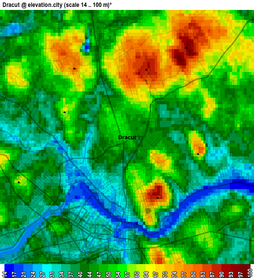
Below is the Elevation map of Dracut, which displays elevation range with different colors. Scale of the first map is from 14 to 100 m (46 to 328 ft) with average elevation of 47.6 meters (=156 ft) [note 1]
These maps also provides idea of topography and contour of this city, they are displayed at different zoom levels. More info about maps, scale and edge coordinates you can find below images.
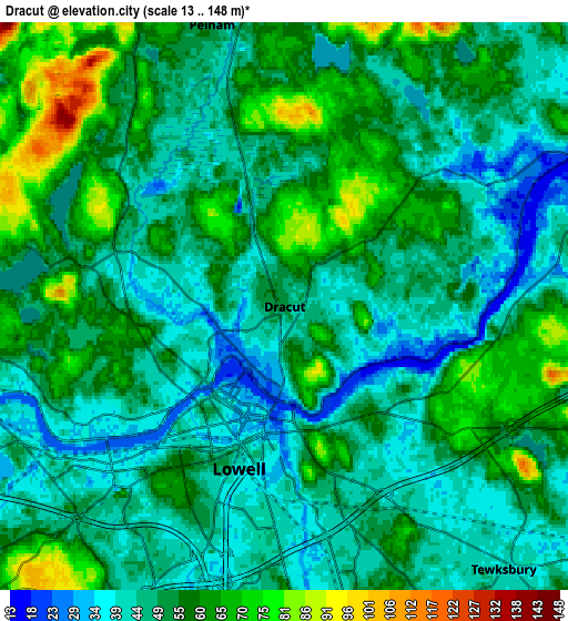
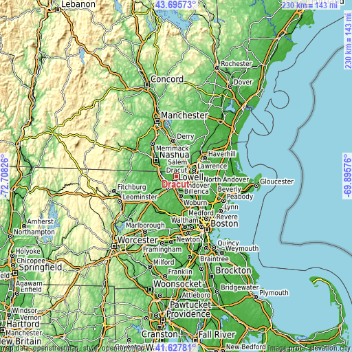
| \ | Map #1 | Map #2 | Topo.Map |
| Scale [m] | 14..100 m | 13..148 m | × |
| Scale [ft] | 46..328 ft | 43..486 ft | × |
| Average | 47.6 m = 156 ft | 51.9 m = 170 ft | × |
| Width | 7.19 km = 4.5 mi | 14.37 km = 8.9 mi | 229.9 km = 142.9 mi |
| Height | 7.19 km = 4.5 mi | 14.37 km = 8.9 mi | 229.9 km = 142.9 mi |
| ↑Max Latitude | 42.702673° | 42.734959° | 43.69573° |
| Latitude at center | 42.67037° | 42.67037° | 42.67037° |
| ↓Min Latitude | 42.63805° | 42.605713° | 41.62781° |
| ← Min Longitude | -71.345955° | -71.389901° | -72.70826° |
| Longitude center | -71.30201° | -71.30201° | -71.30201° |
| →Max Longitude | -71.258065° | -71.214119° | -69.89576° |
Nearby cities:
Cities around Dracut sort by population:
• Lowell elevation 39 m
4.3 km,  195°
195°
• Lawrence 20 m
12.1 km,  70°
70°
• Methuen 39 m
11 km,  55°
55°
• Billerica 79 m
12.7 km,  167°
167°
• Chelmsford 88 m
9.5 km,  214°
214°
• Tewksbury 40 m
8.7 km,  140°
140°
• North Andover 31 m
14 km,  77°
77°
• Windham 64 m
14.5 km,  359°
359°
• Pelham 50 m
7.4 km,  345°
345°
• Tyngsboro 46 m
10 km,  274°
274°
• Andover 61 m
13.6 km,  95°
95°
• Dunstable 72 m
14.8 km, 272°
Multilingual:
 En español:
Dracut elevación 51 m.
 En France:
Dracut élévation 51 m.


Sources and notes:
- [note 1] Map square and city borders are not equal. Map elevation data is calculated only from area inside that square.
- [src 1] Elevation data from geonames database provided with same terms of usage.
- [src 2] The elevation map of Dracut is generated using elevation data from NASA's 3 arcsec (90m) resolution SRTM data.
- [src 3] Base (background) map © OpenStreetMap contributors tiles are generated by Geofabrik and OpenTopoMap.
Copyright & License:
This Dracut Elevation Map is licensed under CC BY-SA. You may reuse any part from this page, if you give a proper credit by linking to this URL:
 More info on terms of use page.