Haverhill elevation
Haverhill (New Hampshire, Grafton County), United States elevation is 194 meters and Haverhill elevation in feet is 636 ft above sea level [src 1]. Haverhill is a populated place (feature code) with elevation that is 85 meters (279 ft) smaller than average city elevation in United States.
Below is the Elevation map of Haverhill, which displays elevation range with different colors. Scale of the first map is from 114 to 382 m (374 to 1253 ft) with average elevation of 206.4 meters (=677 ft) [note 1]
These maps also provides idea of topography and contour of this city, they are displayed at different zoom levels. More info about maps, scale and edge coordinates you can find below images.
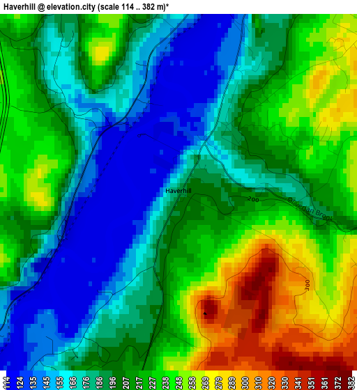
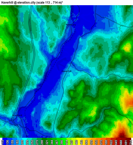
| \ | Map #1 | Map #2 | Topo.Map |
| Scale [m] | 114..382 m | 113..714 m | × |
| Scale [ft] | 374..1253 ft | 371..2343 ft | × |
| Average | 206.4 m = 677 ft | 255.8 m = 839 ft | × |
| Width | 7.03 km = 4.4 mi | 14.05 km = 8.7 mi | 224.8 km = 139.7 mi |
| Height | 7.03 km = 4.4 mi | 14.05 km = 8.7 mi | 224.8 km = 139.7 mi |
| ↑Max Latitude | 44.066095° | 44.097663° | 45.03687° |
| Latitude at center | 44.03451° | 44.03451° | 44.03451° |
| ↓Min Latitude | 44.002908° | 43.97129° | 43.01491° |
| ← Min Longitude | -72.107925° | -72.151871° | -73.47023° |
| Longitude center | -72.06398° | -72.06398° | -72.06398° |
| →Max Longitude | -72.020035° | -71.976089° | -70.65773° |
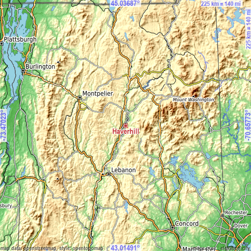
Nearby cities:
Cities around Haverhill sort by population:
• Littleton elevation 246 m
38.2 km,  37°
37°
• Thornton 203 m
34.8 km,  116°
116°
• Lyme 173 m
26.1 km,  196°
196°
• Rumney 159 m
32.5 km,  141°
141°
• Chelsea 254 m
31.1 km,  260°
260°
• South Barre 226 m
38.7 km,  294°
294°
• Woodstock 223 m
31 km,  101°
101°
• Williamstown 272 m
39.4 km,  284°
284°
• Orford 129 m
15.6 km, 202°
• Woodsville 138 m
13.3 km,  9°
9°
• Washington 390 m
30.5 km, 285°
• North Haverhill 152 m
6.9 km,  25°
25°
Multilingual:
 En español:
Haverhill elevación 194 m.
 En France:
Haverhill élévation 194 m.
 Auf Deutsch:
Haverhill höhe über dem Meeresspiegel ist 194 m.

Sources and notes:
- [note 1] Map square and city borders are not equal. Map elevation data is calculated only from area inside that square.
- [src 1] Elevation data from geonames database provided with same terms of usage.
- [src 2] The elevation map of Haverhill is generated using elevation data from NASA's 3 arcsec (90m) resolution SRTM data.
- [src 3] Base (background) map © OpenStreetMap contributors tiles are generated by Geofabrik and OpenTopoMap.
Copyright & License:
This Haverhill Elevation Map is licensed under CC BY-SA. You may reuse any part from this page, if you give a proper credit by linking to this URL:
 More info on terms of use page.