Freedom elevation
Freedom (New Hampshire, Carroll County), United States elevation is 145 meters and Freedom elevation in feet is 476 ft above sea level [src 1]. Freedom is a populated place (feature code) with elevation that is 134 meters (440 ft) smaller than average city elevation in United States.
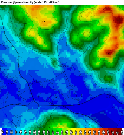
Below is the Elevation map of Freedom, which displays elevation range with different colors. Scale of the first map is from 115 to 475 m (377 to 1558 ft) with average elevation of 200.7 meters (=658 ft) [note 1]
These maps also provides idea of topography and contour of this city, they are displayed at different zoom levels. More info about maps, scale and edge coordinates you can find below images.
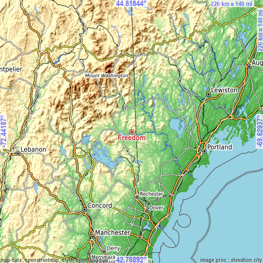
| \ | Map #1 | Topo.Map |
| Scale [m] | 115..475 m | × |
| Scale [ft] | 377..1558 ft | × |
| Average | 200.7 m = 658 ft | × |
| Width | 7.05 km = 4.4 mi | 225.7 km = 140.2 mi |
| Height | 7.05 km = 4.4 mi | 225.7 km = 140.2 mi |
| ↑Max Latitude | 43.844003° | 44.81844° |
| Latitude at center | 43.8123° | 43.8123° |
| ↓Min Latitude | 43.78058° | 42.78892° |
| ← Min Longitude | -71.079565° | -72.44187° |
| Longitude center | -71.03562° | -71.03562° |
| →Max Longitude | -70.991675° | -69.62937° |
Nearby cities:
Cities around Freedom sort by population:
• Ossipee elevation 208 m
15.5 km,  204°
204°
• Tamworth 159 m
19 km,  286°
286°
• Tuftonboro 306 m
19.7 km,  229°
229°
• Madison 175 m
13.2 km,  316°
316°
• Conway 142 m
19.8 km,  339°
339°
• Parsonsfield 220 m
12.8 km,  137°
137°
• Fryeburg 131 m
23.1 km,  10°
10°
• Porter 125 m
8.5 km,  102°
102°
• Hiram 110 m
20 km,  68°
68°
• Effingham 183 m
6.5 km,  151°
151°
• Cornish 108 m
18.8 km,  92°
92°
• Brownfield 130 m
17.3 km,  36°
36°
Multilingual:
 En español:
Freedom elevación 145 m.
 En France:
Freedom élévation 145 m.


Sources and notes:
- [note 1] Map square and city borders are not equal. Map elevation data is calculated only from area inside that square.
- [src 1] Elevation data from geonames database provided with same terms of usage.
- [src 2] The elevation map of Freedom is generated using elevation data from NASA's 3 arcsec (90m) resolution SRTM data.
- [src 3] Base (background) map © OpenStreetMap contributors tiles are generated by Geofabrik and OpenTopoMap.
Copyright & License:
This Freedom Elevation Map is licensed under CC BY-SA. You may reuse any part from this page, if you give a proper credit by linking to this URL:
 More info on terms of use page.