Candia elevation
Candia (New Hampshire, Rockingham County), United States elevation is 114 meters and Candia elevation in feet is 374 ft above sea level [src 1]. Candia is a populated place (feature code) with elevation that is 165 meters (541 ft) smaller than average city elevation in United States.
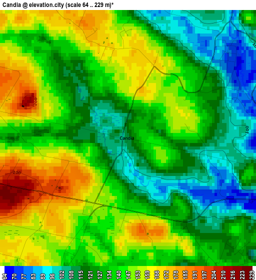
Below is the Elevation map of Candia, which displays elevation range with different colors. Scale of the first map is from 64 to 229 m (210 to 751 ft) with average elevation of 135.9 meters (=446 ft) [note 1]
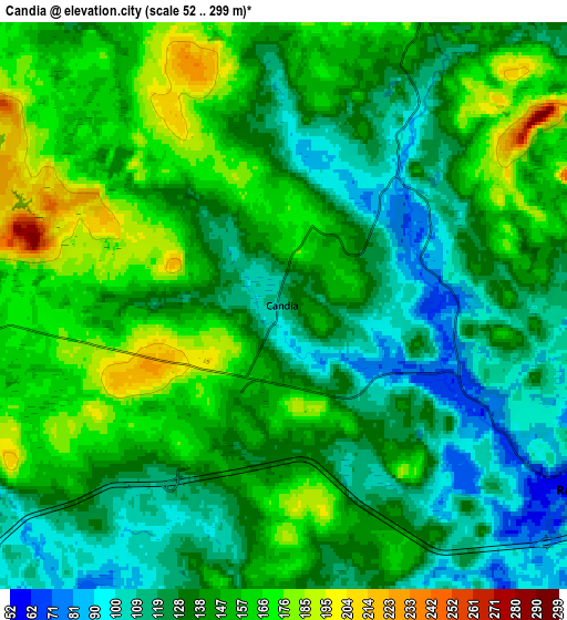
These maps also provides idea of topography and contour of this city, they are displayed at different zoom levels. More info about maps, scale and edge coordinates you can find below images.
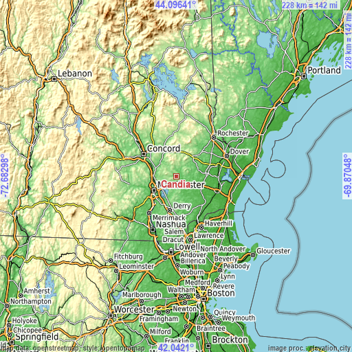
| \ | Map #1 | Map #2 | Topo.Map |
| Scale [m] | 64..229 m | 52..299 m | × |
| Scale [ft] | 210..751 ft | 171..981 ft | × |
| Average | 135.9 m = 446 ft | 140.1 m = 460 ft | × |
| Width | 7.14 km = 4.4 mi | 14.28 km = 8.9 mi | 228.4 km = 141.9 mi |
| Height | 7.14 km = 4.4 mi | 14.28 km = 8.9 mi | 228.4 km = 141.9 mi |
| ↑Max Latitude | 43.10995° | 43.142024° | 44.09641° |
| Latitude at center | 43.07786° | 43.07786° | 43.07786° |
| ↓Min Latitude | 43.045753° | 43.013629° | 42.0421° |
| ← Min Longitude | -71.320675° | -71.364621° | -72.68298° |
| Longitude center | -71.27673° | -71.27673° | -71.27673° |
| →Max Longitude | -71.232785° | -71.188839° | -69.87048° |
Nearby cities:
Cities around Candia sort by population:
• Pembroke elevation 130 m
16.6 km,  297°
297°
• South Hooksett 135 m
14.1 km,  246°
246°
• Suncook 83 m
15.5 km,  292°
292°
• Chester 141 m
13.6 km,  173°
173°
• Auburn 81 m
10 km,  215°
215°
• Epsom 124 m
16.7 km,  344°
344°
• Hooksett 63 m
15.4 km,  277°
277°
• Nottingham 84 m
14.9 km,  74°
74°
• Northwood 173 m
16.5 km,  38°
38°
• Fremont 51 m
14.6 km,  131°
131°
• Raymond 64 m
8.9 km,  121°
121°
• Allenstown 104 m
13.6 km,  310°
310°
Multilingual:
 En español:
Candia elevación 114 m.
 En France:
Candia élévation 114 m.


Sources and notes:
- [note 1] Map square and city borders are not equal. Map elevation data is calculated only from area inside that square.
- [src 1] Elevation data from geonames database provided with same terms of usage.
- [src 2] The elevation map of Candia is generated using elevation data from NASA's 3 arcsec (90m) resolution SRTM data.
- [src 3] Base (background) map © OpenStreetMap contributors tiles are generated by Geofabrik and OpenTopoMap.
Copyright & License:
This Candia Elevation Map is licensed under CC BY-SA. You may reuse any part from this page, if you give a proper credit by linking to this URL:
 More info on terms of use page.