Auburn elevation
Auburn (New Hampshire, Rockingham County), United States elevation is 81 meters and Auburn elevation in feet is 266 ft above sea level [src 1]. Auburn is a populated place (feature code) with elevation that is 198 meters (650 ft) smaller than average city elevation in United States.
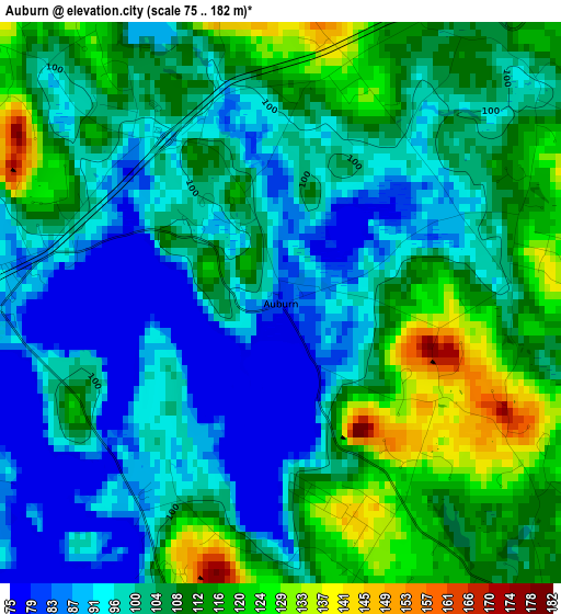
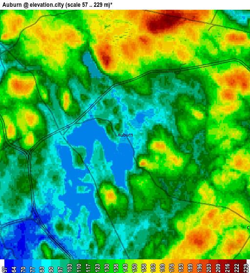
Below is the Elevation map of Auburn, which displays elevation range with different colors. Scale of the first map is from 75 to 182 m (246 to 597 ft) with average elevation of 104 meters (=341 ft) [note 1]
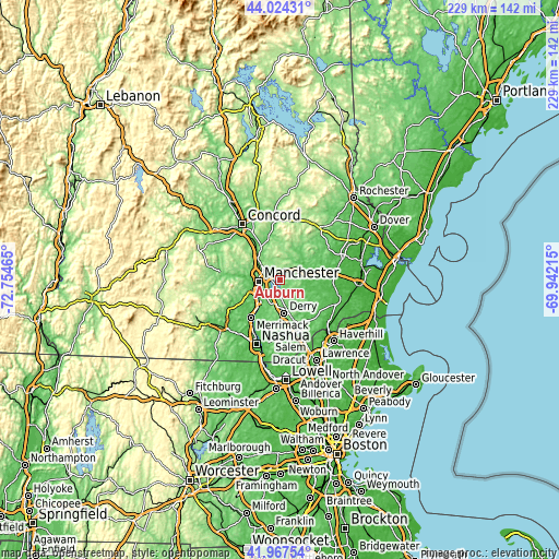
These maps also provides idea of topography and contour of this city, they are displayed at different zoom levels. More info about maps, scale and edge coordinates you can find below images.
| \ | Map #1 | Map #2 | Topo.Map |
| Scale [m] | 75..182 m | 57..229 m | × |
| Scale [ft] | 246..597 ft | 187..751 ft | × |
| Average | 104 m = 341 ft | 124 m = 407 ft | × |
| Width | 7.15 km = 4.4 mi | 14.29 km = 8.9 mi | 228.7 km = 142.1 mi |
| Height | 7.15 km = 4.4 mi | 14.29 km = 8.9 mi | 228.7 km = 142.1 mi |
| ↑Max Latitude | 43.036659° | 43.068771° | 44.02431° |
| Latitude at center | 43.00453° | 43.00453° | 43.00453° |
| ↓Min Latitude | 42.972384° | 42.940222° | 41.96754° |
| ← Min Longitude | -71.392345° | -71.436291° | -72.75465° |
| Longitude center | -71.3484° | -71.3484° | -71.3484° |
| →Max Longitude | -71.304455° | -71.260509° | -69.94215° |
Nearby cities:
Cities around Auburn sort by population:
• Manchester elevation 81 m
8.7 km,  263°
263°
• Derry Village 81 m
12.9 km,  166°
166°
• Derry 89 m
13.9 km, 172°
• Bedford 96 m
15.1 km,  244°
244°
• Londonderry 128 m
15.6 km,  187°
187°
• Sandown 76 m
15.6 km,  122°
122°
• South Hooksett 135 m
7.5 km,  289°
289°
• Chester 141 m
9.1 km,  125°
125°
• Pinardville 85 m
13 km, 264°
• Candia 114 m
10 km,  35°
35°
• Hooksett 63 m
14 km,  317°
317°
• Raymond 64 m
13.9 km,  75°
75°
Multilingual:
 En español:
Auburn elevación 81 m.
 En France:
Auburn élévation 81 m.


Sources and notes:
- [note 1] Map square and city borders are not equal. Map elevation data is calculated only from area inside that square.
- [src 1] Elevation data from geonames database provided with same terms of usage.
- [src 2] The elevation map of Auburn is generated using elevation data from NASA's 3 arcsec (90m) resolution SRTM data.
- [src 3] Base (background) map © OpenStreetMap contributors tiles are generated by Geofabrik and OpenTopoMap.
Copyright & License:
This Auburn Elevation Map is licensed under CC BY-SA. You may reuse any part from this page, if you give a proper credit by linking to this URL:
 More info on terms of use page.