Neligh elevation
Neligh (Nebraska, Antelope County), United States elevation is 537 meters and Neligh elevation in feet is 1762 ft above sea level [src 1]. Neligh is a seat of a second-order administrative division (feature code) with elevation that is 258 meters (846 ft) bigger than average city elevation in United States.
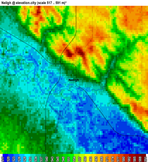
Below is the Elevation map of Neligh, which displays elevation range with different colors. Scale of the first map is from 517 to 591 m (1696 to 1939 ft) with average elevation of 543.5 meters (=1783 ft) [note 1]
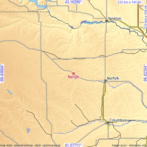
These maps also provides idea of topography and contour of this city, they are displayed at different zoom levels. More info about maps, scale and edge coordinates you can find below images.
| \ | Map #1 | Topo.Map |
| Scale [m] | 517..591 m | × |
| Scale [ft] | 1696..1939 ft | × |
| Average | 543.5 m = 1783 ft | × |
| Width | 7.25 km = 4.5 mi | 231.9 km = 144.1 mi |
| Height | 7.25 km = 4.5 mi | 231.9 km = 144.1 mi |
| ↑Max Latitude | 42.161203° | 43.16296° |
| Latitude at center | 42.12862° | 42.12862° |
| ↓Min Latitude | 42.09602° | 41.07711° |
| ← Min Longitude | -98.073735° | -99.43604° |
| Longitude center | -98.02979° | -98.02979° |
| →Max Longitude | -97.985845° | -96.62354° |
Nearby cities:
Cities around Neligh sort by population:
• Norfolk elevation 463 m
51.8 km,  102°
102°
• O'Neill 608 m
62.6 km,  305°
305°
• Madison 483 m
58.1 km,  125°
125°
• Pierce 484 m
42.2 km,  79°
79°
• Albion 544 m
48.7 km,  177°
177°
• Stanton 450 m
69.4 km,  106°
106°
• Plainview 513 m
31.4 km,  38°
38°
• Battle Creek 486 m
38.4 km, 111°
• Creighton 502 m
38.9 km,  15°
15°
• Greeley 618 m
76.7 km,  212°
212°
• Bartlett 669 m
50.9 km,  237°
237°
• Center 429 m
54.9 km,  13°
13°
Multilingual:
 En español:
Neligh elevación 537 m.
 En France:
Neligh élévation 537 m.


Sources and notes:
- [note 1] Map square and city borders are not equal. Map elevation data is calculated only from area inside that square.
- [src 1] Elevation data from geonames database provided with same terms of usage.
- [src 2] The elevation map of Neligh is generated using elevation data from NASA's 3 arcsec (90m) resolution SRTM data.
- [src 3] Base (background) map © OpenStreetMap contributors tiles are generated by Geofabrik and OpenTopoMap.
Copyright & License:
This Neligh Elevation Map is licensed under CC BY-SA. You may reuse any part from this page, if you give a proper credit by linking to this URL:
 More info on terms of use page.