Center elevation
Center (Nebraska, Knox County), United States elevation is 429 meters and Center elevation in feet is 1407 ft above sea level [src 1]. Center is a seat of a second-order administrative division (feature code) with elevation that is 150 meters (492 ft) bigger than average city elevation in United States.
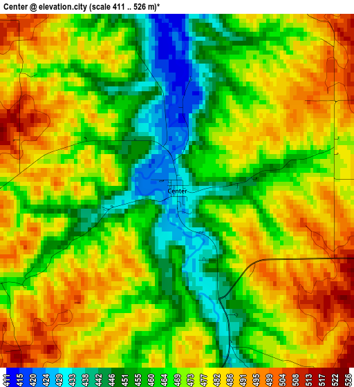
Below is the Elevation map of Center, which displays elevation range with different colors. Scale of the first map is from 411 to 526 m (1348 to 1726 ft) with average elevation of 470.9 meters (=1545 ft) [note 1]
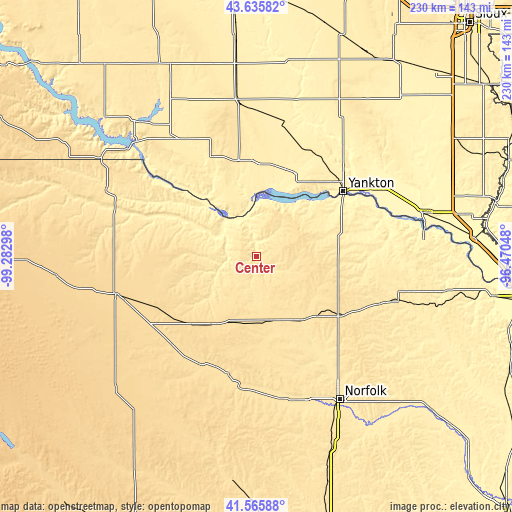
These maps also provides idea of topography and contour of this city, they are displayed at different zoom levels. More info about maps, scale and edge coordinates you can find below images.
| \ | Map #1 | Topo.Map |
| Scale [m] | 411..526 m | × |
| Scale [ft] | 1348..1726 ft | × |
| Average | 470.9 m = 1545 ft | × |
| Width | 7.19 km = 4.5 mi | 230.2 km = 143 mi |
| Height | 7.19 km = 4.5 mi | 230.1 km = 143 mi |
| ↑Max Latitude | 42.641785° | 43.63582° |
| Latitude at center | 42.60945° | 42.60945° |
| ↓Min Latitude | 42.577098° | 41.56588° |
| ← Min Longitude | -97.920675° | -99.28298° |
| Longitude center | -97.87673° | -97.87673° |
| →Max Longitude | -97.832785° | -96.47048° |
Nearby cities:
Cities around Center sort by population:
• Yankton elevation 370 m
48.8 km,  53°
53°
• O'Neill 608 m
65.4 km,  255°
255°
• Springfield 395 m
27.3 km,  356°
356°
• Pierce 484 m
53.9 km,  147°
147°
• Wagner 441 m
62.3 km,  327°
327°
• Neligh 537 m
54.9 km,  193°
193°
• Hartington 430 m
50.1 km,  88°
88°
• Plainview 513 m
29.7 km,  166°
166°
• Battle Creek 486 m
71.6 km,  161°
161°
• Creighton 502 m
16.1 km, 188°
• Tyndall 433 m
42.7 km,  1°
1°
• Olivet 375 m
72.1 km,  13°
13°
Multilingual:
 En español:
Center elevación 429 m.
 En France:
Center élévation 429 m.


Sources and notes:
- [note 1] Map square and city borders are not equal. Map elevation data is calculated only from area inside that square.
- [src 1] Elevation data from geonames database provided with same terms of usage.
- [src 2] The elevation map of Center is generated using elevation data from NASA's 3 arcsec (90m) resolution SRTM data.
- [src 3] Base (background) map © OpenStreetMap contributors tiles are generated by Geofabrik and OpenTopoMap.
Copyright & License:
This Center Elevation Map is licensed under CC BY-SA. You may reuse any part from this page, if you give a proper credit by linking to this URL:
 More info on terms of use page.