Falls City elevation
Falls City (Nebraska, Richardson County), United States elevation is 309 meters and Falls City elevation in feet is 1014 ft above sea level [src 1]. Falls City is a seat of a second-order administrative division (feature code) with elevation that is 30 meters (98 ft) bigger than average city elevation in United States.
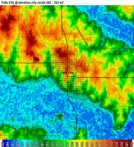
Below is the Elevation map of Falls City, which displays elevation range with different colors. Scale of the first map is from 262 to 323 m (860 to 1060 ft) with average elevation of 287.2 meters (=942 ft) [note 1]
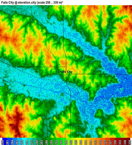
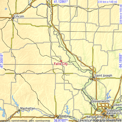
These maps also provides idea of topography and contour of this city, they are displayed at different zoom levels. More info about maps, scale and edge coordinates you can find below images.
| \ | Map #1 | Map #2 | Topo.Map |
| Scale [m] | 262..323 m | 258..339 m | × |
| Scale [ft] | 860..1060 ft | 846..1112 ft | × |
| Average | 287.2 m = 942 ft | 290.7 m = 954 ft | × |
| Width | 7.48 km = 4.6 mi | 14.96 km = 9.3 mi | 239.3 km = 148.7 mi |
| Height | 7.48 km = 4.6 mi | 14.96 km = 9.3 mi | 239.3 km = 148.7 mi |
| ↑Max Latitude | 40.094466° | 40.128075° | 41.12861° |
| Latitude at center | 40.06084° | 40.06084° | 40.06084° |
| ↓Min Latitude | 40.027198° | 39.993539° | 38.97607° |
| ← Min Longitude | -95.645875° | -95.689821° | -97.00818° |
| Longitude center | -95.60193° | -95.60193° | -95.60193° |
| →Max Longitude | -95.557985° | -95.514039° | -94.19568° |
Nearby cities:
Cities around Falls City sort by population:
• Auburn elevation 302 m
42 km,  331°
331°
• Hiawatha 351 m
23.8 km,  166°
166°
• Sabetha 403 m
24.5 km,  223°
223°
• Seneca 350 m
46.8 km,  237°
237°
• Horton 328 m
45 km, 171°
• Tarkio 281 m
46.3 km,  24°
24°
• Rock Port 287 m
39.6 km,  10°
10°
• Mound City 273 m
32.5 km,  76°
76°
• Highland 326 m
36.1 km,  128°
128°
• Troy 337 m
53.5 km, 125°
• Pawnee City 368 m
47.3 km,  276°
276°
• Oregon 337 m
39.8 km,  101°
101°
Multilingual:
 En español:
Falls City elevación 309 m.
 En France:
Falls City élévation 309 m.
 Auf Deutsch:
Falls City höhe über dem Meeresspiegel ist 309 m.

Sources and notes:
- [note 1] Map square and city borders are not equal. Map elevation data is calculated only from area inside that square.
- [src 1] Elevation data from geonames database provided with same terms of usage.
- [src 2] The elevation map of Falls City is generated using elevation data from NASA's 3 arcsec (90m) resolution SRTM data.
- [src 3] Base (background) map © OpenStreetMap contributors tiles are generated by Geofabrik and OpenTopoMap.
Copyright & License:
This Falls City Elevation Map is licensed under CC BY-SA. You may reuse any part from this page, if you give a proper credit by linking to this URL:
 More info on terms of use page.