Rushford elevation
Rushford (Minnesota, Fillmore County), United States elevation is 219 meters and Rushford elevation in feet is 719 ft above sea level [src 1]. Rushford is a populated place (feature code) with elevation that is 60 meters (197 ft) smaller than average city elevation in United States.
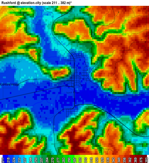
Below is the Elevation map of Rushford, which displays elevation range with different colors. Scale of the first map is from 211 to 382 m (692 to 1253 ft) with average elevation of 280.9 meters (=922 ft) [note 1]
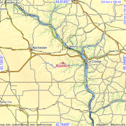
These maps also provides idea of topography and contour of this city, they are displayed at different zoom levels. More info about maps, scale and edge coordinates you can find below images.
| \ | Map #1 | Topo.Map |
| Scale [m] | 211..382 m | × |
| Scale [ft] | 692..1253 ft | × |
| Average | 280.9 m = 922 ft | × |
| Width | 7.05 km = 4.4 mi | 225.7 km = 140.2 mi |
| Height | 7.05 km = 4.4 mi | 225.7 km = 140.2 mi |
| ↑Max Latitude | 43.840005° | 44.81451° |
| Latitude at center | 43.8083° | 43.8083° |
| ↓Min Latitude | 43.776578° | 42.78485° |
| ← Min Longitude | -91.796875° | -93.15918° |
| Longitude center | -91.75293° | -91.75293° |
| →Max Longitude | -91.708985° | -90.34668° |
Nearby cities:
Cities around Rushford sort by population:
• Winona elevation 202 m
28.4 km,  18°
18°
• La Crescent 210 m
36.1 km,  86°
86°
• French Island 199 m
39.9 km,  81°
81°
• Goodview 205 m
28.6 km,  9°
9°
• Saint Charles 345 m
30.7 km,  305°
305°
• Chatfield 308 m
35.2 km,  276°
276°
• Caledonia 364 m
28.2 km,  133°
133°
• Brice Prairie 204 m
39.1 km,  68°
68°
• Trempealeau 213 m
33.2 km,  48°
48°
• Lewiston 369 m
21.7 km,  334°
334°
• Preston 291 m
30.7 km,  239°
239°
• Spring Grove 404 m
29.1 km,  161°
161°
Multilingual:
 En español:
Rushford elevación 219 m.
 En France:
Rushford élévation 219 m.
 Auf Deutsch:
Rushford höhe über dem Meeresspiegel ist 219 m.

Sources and notes:
- [note 1] Map square and city borders are not equal. Map elevation data is calculated only from area inside that square.
- [src 1] Elevation data from geonames database provided with same terms of usage.
- [src 2] The elevation map of Rushford is generated using elevation data from NASA's 3 arcsec (90m) resolution SRTM data.
- [src 3] Base (background) map © OpenStreetMap contributors tiles are generated by Geofabrik and OpenTopoMap.
Copyright & License:
This Rushford Elevation Map is licensed under CC BY-SA. You may reuse any part from this page, if you give a proper credit by linking to this URL:
 More info on terms of use page.