French Island elevation
French Island (Wisconsin, La Crosse County), United States elevation is 199 meters and French Island elevation in feet is 653 ft above sea level [src 1]. French Island is a populated place (feature code) with elevation that is 80 meters (262 ft) smaller than average city elevation in United States.
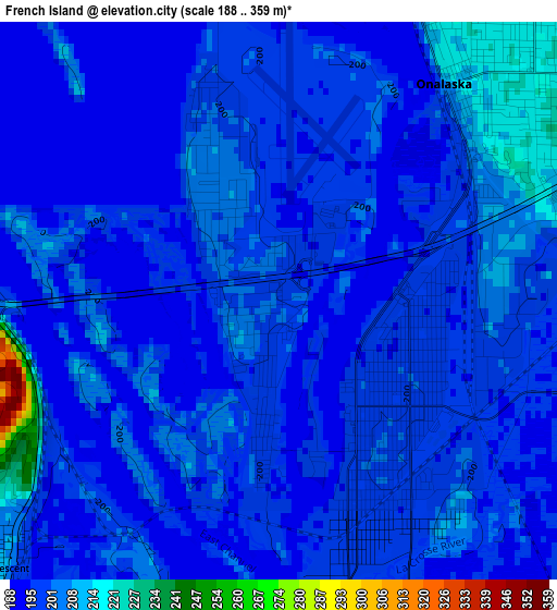
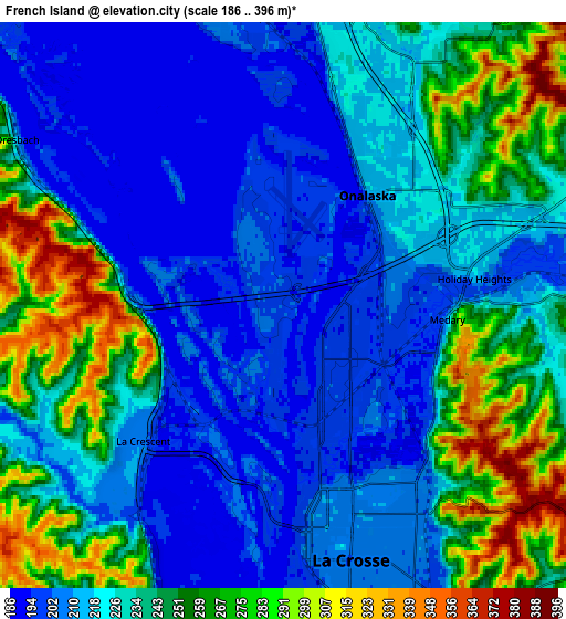
Below is the Elevation map of French Island, which displays elevation range with different colors. Scale of the first map is from 188 to 359 m (617 to 1178 ft) with average elevation of 199.2 meters (=654 ft) [note 1]
These maps also provides idea of topography and contour of this city, they are displayed at different zoom levels. More info about maps, scale and edge coordinates you can find below images.
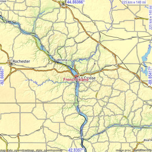
| \ | Map #1 | Map #2 | Topo.Map |
| Scale [m] | 188..359 m | 186..396 m | × |
| Scale [ft] | 617..1178 ft | 610..1299 ft | × |
| Average | 199.2 m = 654 ft | 231.7 m = 760 ft | × |
| Width | 7.05 km = 4.4 mi | 14.09 km = 8.8 mi | 225.5 km = 140.1 mi |
| Height | 7.05 km = 4.4 mi | 14.09 km = 8.8 mi | 225.5 km = 140.1 mi |
| ↑Max Latitude | 43.889979° | 43.92164° | 44.86366° |
| Latitude at center | 43.8583° | 43.8583° | 43.8583° |
| ↓Min Latitude | 43.826605° | 43.794892° | 42.8357° |
| ← Min Longitude | -91.304365° | -91.348311° | -92.66667° |
| Longitude center | -91.26042° | -91.26042° | -91.26042° |
| →Max Longitude | -91.216475° | -91.172529° | -89.85417° |
Nearby cities:
Cities around French Island sort by population:
• La Crosse elevation 203 m
6.5 km,  165°
165°
• North La Crosse 196 m
1.7 km,  143°
143°
• Onalaska 215 m
3.5 km,  34°
34°
• Holmen 218 m
11.7 km,  1°
1°
• West Salem 229 m
15.1 km,  72°
72°
• La Crescent 210 m
4.9 km,  226°
226°
• Caledonia 364 m
31.3 km,  217°
217°
• Brice Prairie 204 m
9.5 km,  340°
340°
• Trempealeau 213 m
21.9 km,  318°
318°
• Galesville 222 m
25.8 km, 344°
• Bangor 226 m
22 km,  79°
79°
• Portland 396 m
33.8 km,  107°
107°
Multilingual:
 En español:
French Island elevación 199 m.
 En France:
French Island élévation 199 m.
 Auf Deutsch:
French Island höhe über dem Meeresspiegel ist 199 m.

Sources and notes:
- [note 1] Map square and city borders are not equal. Map elevation data is calculated only from area inside that square.
- [src 1] Elevation data from geonames database provided with same terms of usage.
- [src 2] The elevation map of French Island is generated using elevation data from NASA's 3 arcsec (90m) resolution SRTM data.
- [src 3] Base (background) map © OpenStreetMap contributors tiles are generated by Geofabrik and OpenTopoMap.
Copyright & License:
This French Island Elevation Map is licensed under CC BY-SA. You may reuse any part from this page, if you give a proper credit by linking to this URL:
 More info on terms of use page.