Baxter elevation
Baxter (Minnesota, Crow Wing County), United States elevation is 366 meters and Baxter elevation in feet is 1201 ft above sea level [src 1]. Baxter is a populated place (feature code) with elevation that is 87 meters (285 ft) bigger than average city elevation in United States.
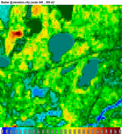
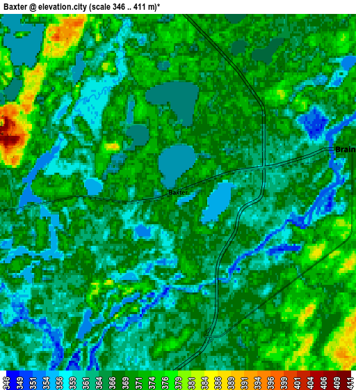
Below is the Elevation map of Baxter, which displays elevation range with different colors. Scale of the first map is from 348 to 389 m (1142 to 1276 ft) with average elevation of 365 meters (=1198 ft) [note 1]
These maps also provides idea of topography and contour of this city, they are displayed at different zoom levels. More info about maps, scale and edge coordinates you can find below images.
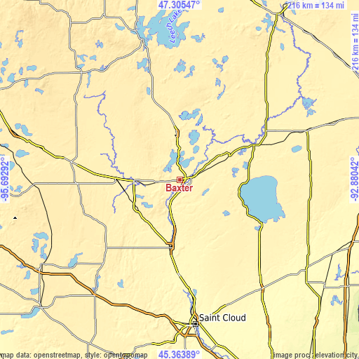
| \ | Map #1 | Map #2 | Topo.Map |
| Scale [m] | 348..389 m | 346..411 m | × |
| Scale [ft] | 1142..1276 ft | 1135..1348 ft | × |
| Average | 365 m = 1198 ft | 366.5 m = 1202 ft | × |
| Width | 6.75 km = 4.2 mi | 13.49 km = 8.4 mi | 215.9 km = 134.2 mi |
| Height | 6.75 km = 4.2 mi | 13.49 km = 8.4 mi | 215.9 km = 134.2 mi |
| ↑Max Latitude | 46.373629° | 46.40394° | 47.30547° |
| Latitude at center | 46.3433° | 46.3433° | 46.3433° |
| ↓Min Latitude | 46.312955° | 46.282592° | 45.36389° |
| ← Min Longitude | -94.330615° | -94.374561° | -95.69292° |
| Longitude center | -94.28667° | -94.28667° | -94.28667° |
| →Max Longitude | -94.242725° | -94.198779° | -92.88042° |
Nearby cities:
Cities around Baxter sort by population:
• Brainerd elevation 365 m
6.8 km,  76°
76°
• Little Falls 339 m
41.2 km,  188°
188°
• Staples 391 m
38.8 km,  272°
272°
• Breezy Point 378 m
27.9 km,  10°
10°
• Crosby 381 m
29.6 km,  58°
58°
• Pequot Lakes 392 m
28.9 km,  356°
356°
• Cross Lake 381 m
37.6 km,  20°
20°
• Nisswa 374 m
19.7 km, 359°
• Pierz 356 m
42.6 km,  160°
160°
• Lake Shore 383 m
16.8 km,  340°
340°
• East Gull Lake 385 m
8.9 km,  323°
323°
• Vineland 381 m
45.3 km,  116°
116°
Multilingual:
 En español:
Baxter elevación 366 m.
 En France:
Baxter élévation 366 m.


Sources and notes:
- [note 1] Map square and city borders are not equal. Map elevation data is calculated only from area inside that square.
- [src 1] Elevation data from geonames database provided with same terms of usage.
- [src 2] The elevation map of Baxter is generated using elevation data from NASA's 3 arcsec (90m) resolution SRTM data.
- [src 3] Base (background) map © OpenStreetMap contributors tiles are generated by Geofabrik and OpenTopoMap.
Copyright & License:
This Baxter Elevation Map is licensed under CC BY-SA. You may reuse any part from this page, if you give a proper credit by linking to this URL:
 More info on terms of use page.