Ypsilanti elevation
Ypsilanti (Michigan, Washtenaw County), United States elevation is 224 meters and Ypsilanti elevation in feet is 735 ft above sea level [src 1]. Ypsilanti is a populated place (feature code) with elevation that is 55 meters (180 ft) smaller than average city elevation in United States.
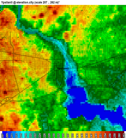
Below is the Elevation map of Ypsilanti, which displays elevation range with different colors. Scale of the first map is from 207 to 262 m (679 to 860 ft) with average elevation of 232.1 meters (=761 ft) [note 1]
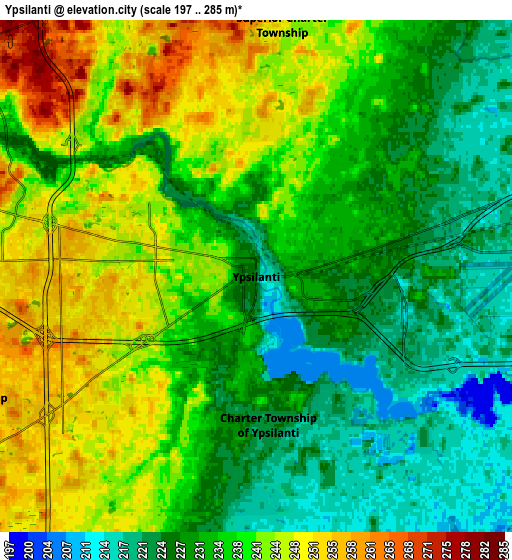
These maps also provides idea of topography and contour of this city, they are displayed at different zoom levels. More info about maps, scale and edge coordinates you can find below images.
| \ | Map #1 | Map #2 | Topo.Map |
| Scale [m] | 207..262 m | 197..285 m | × |
| Scale [ft] | 679..860 ft | 646..935 ft | × |
| Average | 232.1 m = 761 ft | 235.2 m = 772 ft | × |
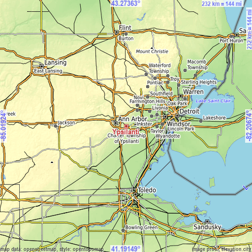
| Width | 7.23 km = 4.5 mi | 14.47 km = 9 mi | 231.5 km = 143.8 mi |
| Height | 7.23 km = 4.5 mi | 14.47 km = 9 mi | 231.5 km = 143.8 mi |
| ↑Max Latitude | 42.273675° | 42.306184° | 43.27363° |
| Latitude at center | 42.24115° | 42.24115° | 42.24115° |
| ↓Min Latitude | 42.208608° | 42.176049° | 41.19149° |
| ← Min Longitude | -83.656935° | -83.700881° | -85.01924° |
| Longitude center | -83.61299° | -83.61299° | -83.61299° |
| →Max Longitude | -83.569045° | -83.525099° | -82.20674° |
Nearby cities:
Cities around Ypsilanti sort by population:
• Ann Arbor elevation 271 m
11.3 km,  291°
291°
• Canton 209 m
13.1 km,  55°
55°
• Westland 202 m
19.8 km, 62°
• Romulus 203 m
17.9 km,  96°
96°
• Wayne 203 m
19.2 km,  76°
76°
• South Lyon 282 m
24.6 km,  352°
352°
• Saline 251 m
16.2 km,  239°
239°
• Plymouth 222 m
18.6 km,  39°
39°
• Whitmore Lake 286 m
24.6 km,  333°
333°
• Northville 255 m
23.7 km,  26°
26°
• Milan 213 m
18.2 km,  198°
198°
• Belleville 208 m
11.3 km,  111°
111°
Multilingual:
 En español:
Ypsilanti elevación 224 m.
 En France:
Ypsilanti élévation 224 m.
 Auf Deutsch:
Ypsilanti höhe über dem Meeresspiegel ist 224 m.

Sources and notes:
- [note 1] Map square and city borders are not equal. Map elevation data is calculated only from area inside that square.
- [src 1] Elevation data from geonames database provided with same terms of usage.
- [src 2] The elevation map of Ypsilanti is generated using elevation data from NASA's 3 arcsec (90m) resolution SRTM data.
- [src 3] Base (background) map © OpenStreetMap contributors tiles are generated by Geofabrik and OpenTopoMap.
Copyright & License:
This Ypsilanti Elevation Map is licensed under CC BY-SA. You may reuse any part from this page, if you give a proper credit by linking to this URL:
 More info on terms of use page.