Canton elevation
Canton (Michigan, Wayne County), United States elevation is 209 meters and Canton elevation in feet is 686 ft above sea level [src 1]. Canton is a populated place (feature code) with elevation that is 70 meters (230 ft) smaller than average city elevation in United States.
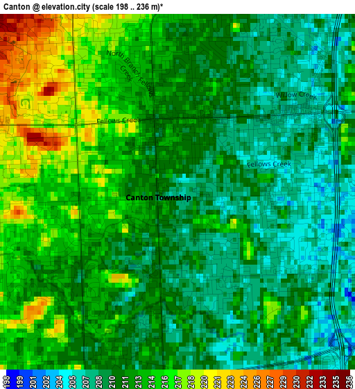
Below is the Elevation map of Canton, which displays elevation range with different colors. Scale of the first map is from 198 to 236 m (650 to 774 ft) with average elevation of 211.7 meters (=695 ft) [note 1]
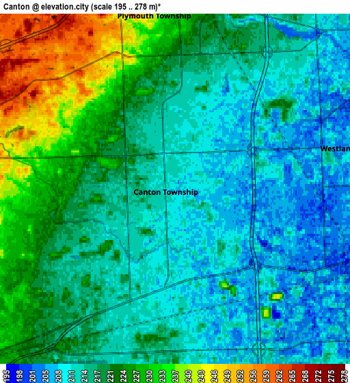
These maps also provides idea of topography and contour of this city, they are displayed at different zoom levels. More info about maps, scale and edge coordinates you can find below images.
| \ | Map #1 | Map #2 | Topo.Map |
| Scale [m] | 198..236 m | 195..278 m | × |
| Scale [ft] | 650..774 ft | 640..912 ft | × |
| Average | 211.7 m = 695 ft | 218.3 m = 716 ft | × |
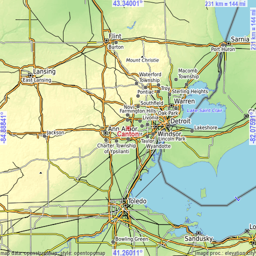
| Width | 7.23 km = 4.5 mi | 14.45 km = 9 mi | 231.3 km = 143.7 mi |
| Height | 7.23 km = 4.5 mi | 14.45 km = 9 mi | 231.3 km = 143.7 mi |
| ↑Max Latitude | 42.34114° | 42.373614° | 43.34001° |
| Latitude at center | 42.30865° | 42.30865° | 42.30865° |
| ↓Min Latitude | 42.276143° | 42.243619° | 41.26011° |
| ← Min Longitude | -83.526105° | -83.570051° | -84.88841° |
| Longitude center | -83.48216° | -83.48216° | -83.48216° |
| →Max Longitude | -83.438215° | -83.394269° | -82.07591° |
Nearby cities:
Cities around Canton sort by population:
• Livonia elevation 197 m
12.5 km,  58°
58°
• Westland 202 m
7 km,  75°
75°
• Dearborn Heights 190 m
17.5 km, 79°
• Redford 190 m
17.4 km, 61°
• Garden City 195 m
12.6 km, 81°
• Inkster 191 m
14.3 km,  96°
96°
• Romulus 203 m
11.9 km,  143°
143°
• Ypsilanti 224 m
13.1 km,  235°
235°
• Wayne 203 m
8.4 km,  111°
111°
• Plymouth 222 m
7 km,  8°
8°
• Northville 255 m
13.6 km,  359°
359°
• Belleville 208 m
11.6 km,  181°
181°
Multilingual:
 En español:
Canton elevación 209 m.
 En France:
Canton élévation 209 m.


Sources and notes:
- [note 1] Map square and city borders are not equal. Map elevation data is calculated only from area inside that square.
- [src 1] Elevation data from geonames database provided with same terms of usage.
- [src 2] The elevation map of Canton is generated using elevation data from NASA's 3 arcsec (90m) resolution SRTM data.
- [src 3] Base (background) map © OpenStreetMap contributors tiles are generated by Geofabrik and OpenTopoMap.
Copyright & License:
This Canton Elevation Map is licensed under CC BY-SA. You may reuse any part from this page, if you give a proper credit by linking to this URL:
 More info on terms of use page.