Worcester elevation
Worcester (Massachusetts, Worcester County), United States elevation is 164 meters and Worcester elevation in feet is 538 ft above sea level [src 1]. Worcester is a seat of a second-order administrative division (feature code) with elevation that is 115 meters (377 ft) smaller than average city elevation in United States.
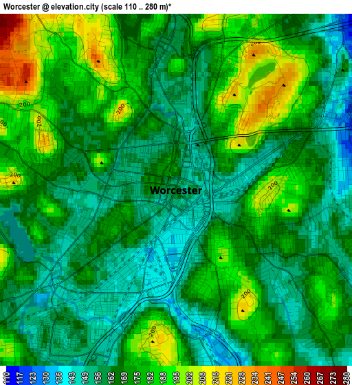
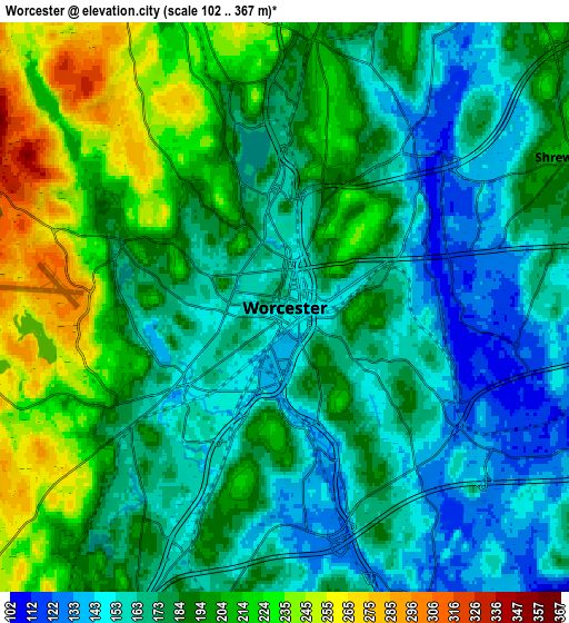
Below is the Elevation map of Worcester, which displays elevation range with different colors. Scale of the first map is from 110 to 280 m (361 to 919 ft) with average elevation of 170.4 meters (=559 ft) [note 1]
These maps also provides idea of topography and contour of this city, they are displayed at different zoom levels. More info about maps, scale and edge coordinates you can find below images.
| \ | Map #1 | Map #2 | Topo.Map |
| Scale [m] | 110..280 m | 102..367 m | × |
| Scale [ft] | 361..919 ft | 335..1204 ft | × |
| Average | 170.4 m = 559 ft | 184.2 m = 604 ft | × |
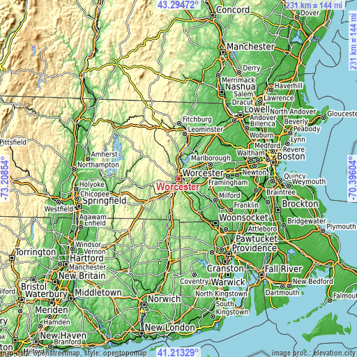
| Width | 7.23 km = 4.5 mi | 14.46 km = 9 mi | 231.4 km = 143.8 mi |
| Height | 7.23 km = 4.5 mi | 14.46 km = 9 mi | 231.4 km = 143.8 mi |
| ↑Max Latitude | 42.295104° | 42.327602° | 43.29472° |
| Latitude at center | 42.26259° | 42.26259° | 42.26259° |
| ↓Min Latitude | 42.230059° | 42.197511° | 41.21329° |
| ← Min Longitude | -71.846235° | -71.890181° | -73.20854° |
| Longitude center | -71.80229° | -71.80229° | -71.80229° |
| →Max Longitude | -71.758345° | -71.714399° | -70.39604° |
Nearby cities:
Cities around Worcester sort by population:
• Shrewsbury elevation 199 m
8.2 km,  63°
63°
• Holden 253 m
11.1 km,  333°
333°
• Auburn 189 m
8 km,  199°
199°
• Grafton 149 m
11.4 km,  122°
122°
• Millbury 124 m
8.4 km,  155°
155°
• Leicester 302 m
8.9 km,  258°
258°
• Sutton 218 m
12.9 km,  165°
165°
• Hamilton Worcester 153 m
2.9 km,  103°
103°
• West Boylston 168 m
11.7 km,  6°
6°
• Northborough 93 m
14.7 km, 64°
• Paxton 346 m
11.7 km,  297°
297°
• Sunderland 157 m
3.2 km,  128°
128°
Multilingual:
 En español:
Worcester elevación 164 m.
 En France:
Worcester élévation 164 m.
 Auf Deutsch:
Worcester höhe über dem Meeresspiegel ist 164 m.

Sources and notes:
- [note 1] Map square and city borders are not equal. Map elevation data is calculated only from area inside that square.
- [src 1] Elevation data from geonames database provided with same terms of usage.
- [src 2] The elevation map of Worcester is generated using elevation data from NASA's 3 arcsec (90m) resolution SRTM data.
- [src 3] Base (background) map © OpenStreetMap contributors tiles are generated by Geofabrik and OpenTopoMap.
Copyright & License:
This Worcester Elevation Map is licensed under CC BY-SA. You may reuse any part from this page, if you give a proper credit by linking to this URL:
 More info on terms of use page.