Sycamore elevation
Sycamore (Illinois, DeKalb County), United States elevation is 266 meters and Sycamore elevation in feet is 873 ft above sea level [src 1]. Sycamore is a seat of a second-order administrative division (feature code) with elevation that is 13 meters (43 ft) smaller than average city elevation in United States.
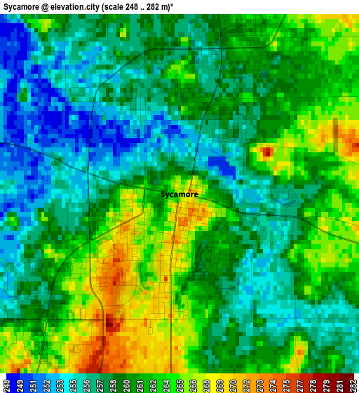
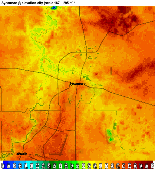
Below is the Elevation map of Sycamore, which displays elevation range with different colors. Scale of the first map is from 248 to 282 m (814 to 925 ft) with average elevation of 260 meters (=853 ft) [note 1]
These maps also provides idea of topography and contour of this city, they are displayed at different zoom levels. More info about maps, scale and edge coordinates you can find below images.
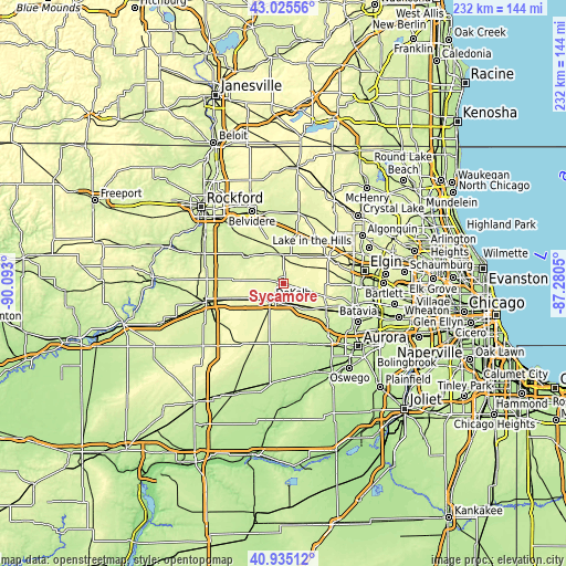
| \ | Map #1 | Map #2 | Topo.Map |
| Scale [m] | 248..282 m | 187..295 m | × |
| Scale [ft] | 814..925 ft | 614..968 ft | × |
| Average | 260 m = 853 ft | 264.5 m = 868 ft | × |
| Width | 7.26 km = 4.5 mi | 14.53 km = 9 mi | 232.4 km = 144.4 mi |
| Height | 7.26 km = 4.5 mi | 14.53 km = 9 mi | 232.4 km = 144.4 mi |
| ↑Max Latitude | 42.021575° | 42.054213° | 43.02556° |
| Latitude at center | 41.98892° | 41.98892° | 41.98892° |
| ↓Min Latitude | 41.956248° | 41.92356° | 40.93512° |
| ← Min Longitude | -88.730695° | -88.774641° | -90.093° |
| Longitude center | -88.68675° | -88.68675° | -88.68675° |
| →Max Longitude | -88.642805° | -88.598859° | -87.2805° |
Nearby cities:
Cities around Sycamore sort by population:
• DeKalb elevation 270 m
8.4 km,  218°
218°
• Wasco 253 m
24 km,  103°
103°
• Pingree Grove 280 m
24.3 km,  68°
68°
• Hampshire 277 m
17.7 km,  46°
46°
• Elburn 261 m
20.7 km,  121°
121°
• Genoa 256 m
12.1 km,  357°
357°
• Cortland 277 m
7.7 km,  181°
181°
• Kirkland 235 m
17.8 km,  310°
310°
• Maple Park 264 m
11.6 km,  141°
141°
• Kingston 240 m
13.7 km,  334°
334°
• Malta 280 m
15.8 km,  245°
245°
• Lily Lake 295 m
17.8 km, 104°
Multilingual:
 En español:
Sycamore elevación 266 m.
 En France:
Sycamore élévation 266 m.
 Auf Deutsch:
Sycamore höhe über dem Meeresspiegel ist 266 m.

Sources and notes:
- [note 1] Map square and city borders are not equal. Map elevation data is calculated only from area inside that square.
- [src 1] Elevation data from geonames database provided with same terms of usage.
- [src 2] The elevation map of Sycamore is generated using elevation data from NASA's 3 arcsec (90m) resolution SRTM data.
- [src 3] Base (background) map © OpenStreetMap contributors tiles are generated by Geofabrik and OpenTopoMap.
Copyright & License:
This Sycamore Elevation Map is licensed under CC BY-SA. You may reuse any part from this page, if you give a proper credit by linking to this URL:
 More info on terms of use page.