Cortland elevation
Cortland (Illinois, DeKalb County), United States elevation is 277 meters and Cortland elevation in feet is 909 ft above sea level [src 1]. Cortland is a populated place (feature code) with elevation that is 2 meters (7 ft) smaller than average city elevation in United States.
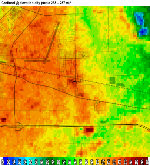
Below is the Elevation map of Cortland, which displays elevation range with different colors. Scale of the first map is from 238 to 287 m (781 to 942 ft) with average elevation of 269.4 meters (=884 ft) [note 1]
These maps also provides idea of topography and contour of this city, they are displayed at different zoom levels. More info about maps, scale and edge coordinates you can find below images.

| \ | Map #1 | Map #2 | Topo.Map |
| Scale [m] | 238..287 m | 238..298 m | × |
| Scale [ft] | 781..942 ft | 781..978 ft | × |
| Average | 269.4 m = 884 ft | 265.3 m = 870 ft | × |
| Width | 7.27 km = 4.5 mi | 14.54 km = 9 mi | 232.7 km = 144.6 mi |
| Height | 7.27 km = 4.5 mi | 14.54 km = 9 mi | 232.7 km = 144.6 mi |
| ↑Max Latitude | 41.95272° | 41.985394° | 42.9578° |
| Latitude at center | 41.92003° | 41.92003° | 41.92003° |
| ↓Min Latitude | 41.887323° | 41.854599° | 40.8651° |
| ← Min Longitude | -88.732645° | -88.776591° | -90.09495° |
| Longitude center | -88.6887° | -88.6887° | -88.6887° |
| →Max Longitude | -88.644755° | -88.600809° | -87.28245° |
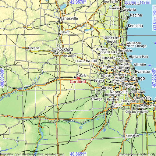
Nearby cities:
Cities around Cortland sort by population:
• DeKalb elevation 270 m
5.2 km,  281°
281°
• Sycamore 266 m
7.7 km,  1°
1°
• Elburn 261 m
18.2 km,  99°
99°
• Genoa 256 m
19.7 km,  358°
358°
• Hinckley 229 m
17.3 km,  166°
166°
• Kirkland 235 m
23.4 km,  325°
325°
• Waterman 256 m
17.9 km,  203°
203°
• Maple Park 264 m
7.5 km, 100°
• Big Rock 217 m
21 km,  145°
145°
• Kingston 240 m
20.8 km,  343°
343°
• Malta 280 m
14.3 km,  274°
274°
• Lily Lake 295 m
17.7 km,  79°
79°
Multilingual:
 En español:
Cortland elevación 277 m.
 En France:
Cortland élévation 277 m.
 Auf Deutsch:
Cortland höhe über dem Meeresspiegel ist 277 m.

Sources and notes:
- [note 1] Map square and city borders are not equal. Map elevation data is calculated only from area inside that square.
- [src 1] Elevation data from geonames database provided with same terms of usage.
- [src 2] The elevation map of Cortland is generated using elevation data from NASA's 3 arcsec (90m) resolution SRTM data.
- [src 3] Base (background) map © OpenStreetMap contributors tiles are generated by Geofabrik and OpenTopoMap.
Copyright & License:
This Cortland Elevation Map is licensed under CC BY-SA. You may reuse any part from this page, if you give a proper credit by linking to this URL:
 More info on terms of use page.