Oquawka elevation
Oquawka (Illinois, Henderson County), United States elevation is 170 meters and Oquawka elevation in feet is 558 ft above sea level [src 1]. Oquawka is a seat of a second-order administrative division (feature code) with elevation that is 109 meters (358 ft) smaller than average city elevation in United States.
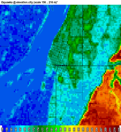
Below is the Elevation map of Oquawka, which displays elevation range with different colors. Scale of the first map is from 156 to 216 m (512 to 709 ft) with average elevation of 169.7 meters (=557 ft) [note 1]
These maps also provides idea of topography and contour of this city, they are displayed at different zoom levels. More info about maps, scale and edge coordinates you can find below images.
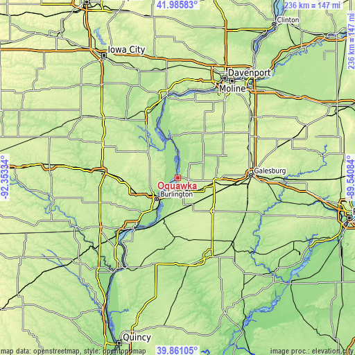
| \ | Map #1 | Topo.Map |
| Scale [m] | 156..216 m | × |
| Scale [ft] | 512..709 ft | × |
| Average | 169.7 m = 557 ft | × |
| Width | 7.38 km = 4.6 mi | 236.3 km = 146.8 mi |
| Height | 7.38 km = 4.6 mi | 236.2 km = 146.8 mi |
| ↑Max Latitude | 40.965172° | 41.98583° |
| Latitude at center | 40.93198° | 40.93198° |
| ↓Min Latitude | 40.898772° | 39.86105° |
| ← Min Longitude | -90.991035° | -92.35334° |
| Longitude center | -90.94709° | -90.94709° |
| →Max Longitude | -90.903145° | -89.54084° |
Nearby cities:
Cities around Oquawka sort by population:
• Galesburg elevation 237 m
48.4 km,  87°
87°
• Burlington 189 m
19.6 km,  225°
225°
• Fort Madison 161 m
45.7 km,  222°
222°
• Monmouth 236 m
25.3 km,  95°
95°
• Aledo 226 m
34.1 km,  29°
29°
• Abingdon 231 m
48 km,  107°
107°
• West Burlington 214 m
21.2 km,  235°
235°
• Wapello 179 m
34.2 km,  324°
324°
• New London 237 m
38 km,  269°
269°
• Mediapolis 237 m
20.1 km,  294°
294°
• La Harpe 214 m
38.8 km,  182°
182°
• Winfield 209 m
46.6 km,  297°
297°
Multilingual:
 En español:
Oquawka elevación 170 m.
 En France:
Oquawka élévation 170 m.


Sources and notes:
- [note 1] Map square and city borders are not equal. Map elevation data is calculated only from area inside that square.
- [src 1] Elevation data from geonames database provided with same terms of usage.
- [src 2] The elevation map of Oquawka is generated using elevation data from NASA's 3 arcsec (90m) resolution SRTM data.
- [src 3] Base (background) map © OpenStreetMap contributors tiles are generated by Geofabrik and OpenTopoMap.
Copyright & License:
This Oquawka Elevation Map is licensed under CC BY-SA. You may reuse any part from this page, if you give a proper credit by linking to this URL:
 More info on terms of use page.