West Liberty elevation
West Liberty (Iowa, Muscatine County), United States elevation is 207 meters and West Liberty elevation in feet is 679 ft above sea level [src 1]. West Liberty is a populated place (feature code) with elevation that is 72 meters (236 ft) smaller than average city elevation in United States.
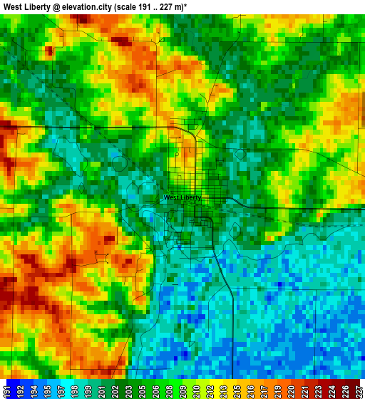
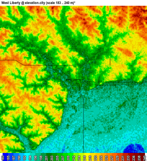
Below is the Elevation map of West Liberty, which displays elevation range with different colors. Scale of the first map is from 191 to 227 m (627 to 745 ft) with average elevation of 205.9 meters (=676 ft) [note 1]
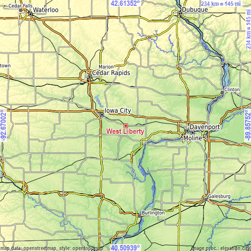
These maps also provides idea of topography and contour of this city, they are displayed at different zoom levels. More info about maps, scale and edge coordinates you can find below images.
| \ | Map #1 | Map #2 | Topo.Map |
| Scale [m] | 191..227 m | 183..240 m | × |
| Scale [ft] | 627..745 ft | 600..787 ft | × |
| Average | 205.9 m = 676 ft | 208.4 m = 684 ft | × |
| Width | 7.31 km = 4.5 mi | 14.62 km = 9.1 mi | 234 km = 145.4 mi |
| Height | 7.31 km = 4.5 mi | 14.62 km = 9.1 mi | 234 km = 145.4 mi |
| ↑Max Latitude | 41.602889° | 41.635741° | 42.61352° |
| Latitude at center | 41.57002° | 41.57002° | 41.57002° |
| ↓Min Latitude | 41.537134° | 41.504232° | 40.50939° |
| ← Min Longitude | -91.307715° | -91.351661° | -92.67002° |
| Longitude center | -91.26377° | -91.26377° | -91.26377° |
| →Max Longitude | -91.219825° | -91.175879° | -89.85752° |
Nearby cities:
Cities around West Liberty sort by population:
• Iowa City elevation 204 m
24.4 km,  294°
294°
• Muscatine 178 m
24.5 km,  131°
131°
• Coralville 208 m
28.9 km, 294°
• Tipton 253 m
24.9 km,  26°
26°
• Wilton 210 m
20.6 km,  84°
84°
• Solon 244 m
32.6 km,  324°
324°
• West Branch 222 m
13.2 km,  328°
328°
• Columbus Junction 186 m
33.2 km,  194°
194°
• Durant 220 m
29.5 km, 83°
• Lone Tree 220 m
16.3 km,  235°
235°
• University Heights 239 m
26.1 km, 291°
• Riverside 204 m
28.3 km,  249°
249°
Multilingual:
 En español:
West Liberty elevación 207 m.
 En France:
West Liberty élévation 207 m.
 Auf Deutsch:
West Liberty höhe über dem Meeresspiegel ist 207 m.

Sources and notes:
- [note 1] Map square and city borders are not equal. Map elevation data is calculated only from area inside that square.
- [src 1] Elevation data from geonames database provided with same terms of usage.
- [src 2] The elevation map of West Liberty is generated using elevation data from NASA's 3 arcsec (90m) resolution SRTM data.
- [src 3] Base (background) map © OpenStreetMap contributors tiles are generated by Geofabrik and OpenTopoMap.
Copyright & License:
This West Liberty Elevation Map is licensed under CC BY-SA. You may reuse any part from this page, if you give a proper credit by linking to this URL:
 More info on terms of use page.