Durant elevation
Durant (Iowa, Cedar County), United States elevation is 220 meters and Durant elevation in feet is 722 ft above sea level [src 1]. Durant is a populated place (feature code) with elevation that is 59 meters (194 ft) smaller than average city elevation in United States.
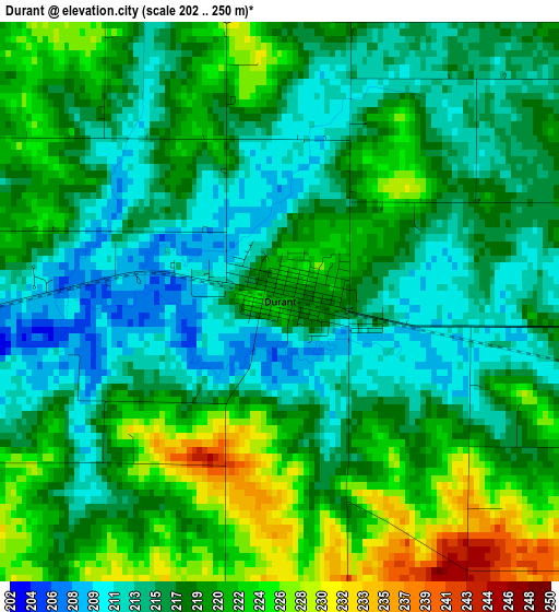
Below is the Elevation map of Durant, which displays elevation range with different colors. Scale of the first map is from 202 to 250 m (663 to 820 ft) with average elevation of 218 meters (=715 ft) [note 1]
These maps also provides idea of topography and contour of this city, they are displayed at different zoom levels. More info about maps, scale and edge coordinates you can find below images.
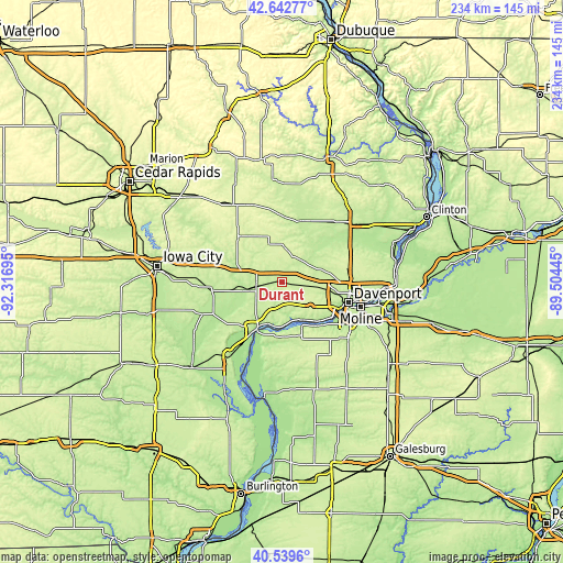
| \ | Map #1 | Topo.Map |
| Scale [m] | 202..250 m | × |
| Scale [ft] | 663..820 ft | × |
| Average | 218 m = 715 ft | × |
| Width | 7.31 km = 4.5 mi | 233.9 km = 145.3 mi |
| Height | 7.31 km = 4.5 mi | 233.8 km = 145.3 mi |
| ↑Max Latitude | 41.632604° | 42.64277° |
| Latitude at center | 41.59975° | 41.59975° |
| ↓Min Latitude | 41.566879° | 40.5396° |
| ← Min Longitude | -90.954645° | -92.31695° |
| Longitude center | -90.9107° | -90.9107° |
| →Max Longitude | -90.866755° | -89.50445° |
Nearby cities:
Cities around Durant sort by population:
• Davenport elevation 182 m
29 km,  106°
106°
• Rock Island 174 m
29.4 km, 109°
• Muscatine 178 m
22.4 km,  209°
209°
• Eldridge 243 m
27.9 km,  76°
76°
• West Liberty 207 m
29.5 km,  263°
263°
• Tipton 253 m
26.1 km,  316°
316°
• Wilton 210 m
8.9 km, 262°
• Park View 238 m
32.1 km,  70°
70°
• Blue Grass 242 m
15.7 km,  129°
129°
• Walcott 223 m
11.6 km,  98°
98°
• Buffalo 173 m
22.3 km,  135°
135°
• Andalusia 176 m
24 km, 138°
Multilingual:
 En español:
Durant elevación 220 m.
 En France:
Durant élévation 220 m.


Sources and notes:
- [note 1] Map square and city borders are not equal. Map elevation data is calculated only from area inside that square.
- [src 1] Elevation data from geonames database provided with same terms of usage.
- [src 2] The elevation map of Durant is generated using elevation data from NASA's 3 arcsec (90m) resolution SRTM data.
- [src 3] Base (background) map © OpenStreetMap contributors tiles are generated by Geofabrik and OpenTopoMap.
Copyright & License:
This Durant Elevation Map is licensed under CC BY-SA. You may reuse any part from this page, if you give a proper credit by linking to this URL:
 More info on terms of use page.