Sumner elevation
Sumner (Iowa, Bremer County), United States elevation is 324 meters and Sumner elevation in feet is 1063 ft above sea level [src 1]. Sumner is a populated place (feature code) with elevation that is 45 meters (148 ft) bigger than average city elevation in United States.
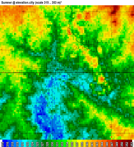
Below is the Elevation map of Sumner, which displays elevation range with different colors. Scale of the first map is from 315 to 353 m (1033 to 1158 ft) with average elevation of 331.1 meters (=1086 ft) [note 1]
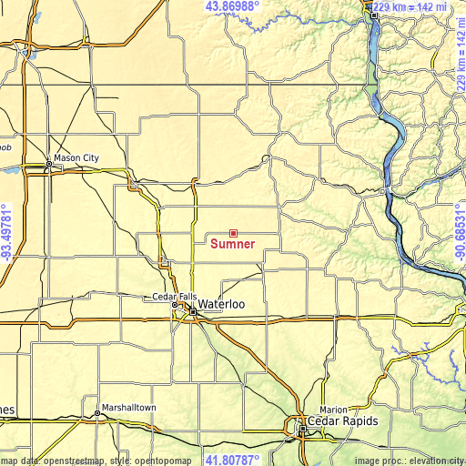
These maps also provides idea of topography and contour of this city, they are displayed at different zoom levels. More info about maps, scale and edge coordinates you can find below images.
| \ | Map #1 | Topo.Map |
| Scale [m] | 315..353 m | × |
| Scale [ft] | 1033..1158 ft | × |
| Average | 331.1 m = 1086 ft | × |
| Width | 7.16 km = 4.4 mi | 229.3 km = 142.5 mi |
| Height | 7.16 km = 4.4 mi | 229.3 km = 142.5 mi |
| ↑Max Latitude | 42.879691° | 43.86988° |
| Latitude at center | 42.84748° | 42.84748° |
| ↓Min Latitude | 42.815252° | 41.80787° |
| ← Min Longitude | -92.135505° | -93.49781° |
| Longitude center | -92.09156° | -92.09156° |
| →Max Longitude | -92.047615° | -90.68531° |
Nearby cities:
Cities around Sumner sort by population:
• Waverly elevation 281 m
34.1 km,  246°
246°
• Oelwein 317 m
24.2 km,  143°
143°
• New Hampton 356 m
29.9 km,  321°
321°
• Jesup 299 m
41.4 km,  176°
176°
• West Union 360 m
26.4 km,  60°
60°
• Denver 286 m
28 km,  225°
225°
• Nashua 301 m
38.1 km,  287°
287°
• Fayette 306 m
23.6 km,  91°
91°
• Tripoli 316 m
14.3 km, 252°
• Shell Rock 282 m
42.9 km, 249°
• Elk Run Heights 260 m
44.4 km,  197°
197°
• Fairbank 299 m
23.4 km,  171°
171°
Multilingual:
 En español:
Sumner elevación 324 m.
 En France:
Sumner élévation 324 m.


Sources and notes:
- [note 1] Map square and city borders are not equal. Map elevation data is calculated only from area inside that square.
- [src 1] Elevation data from geonames database provided with same terms of usage.
- [src 2] The elevation map of Sumner is generated using elevation data from NASA's 3 arcsec (90m) resolution SRTM data.
- [src 3] Base (background) map © OpenStreetMap contributors tiles are generated by Geofabrik and OpenTopoMap.
Copyright & License:
This Sumner Elevation Map is licensed under CC BY-SA. You may reuse any part from this page, if you give a proper credit by linking to this URL:
 More info on terms of use page.