Mason City elevation
Mason City (Iowa, Cerro Gordo County), United States elevation is 348 meters and Mason City elevation in feet is 1142 ft above sea level [src 1]. Mason City is a seat of a second-order administrative division (feature code) with elevation that is 69 meters (226 ft) bigger than average city elevation in United States.
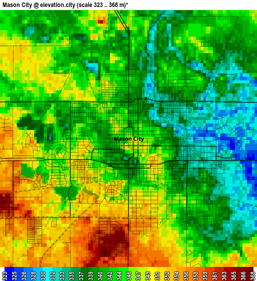
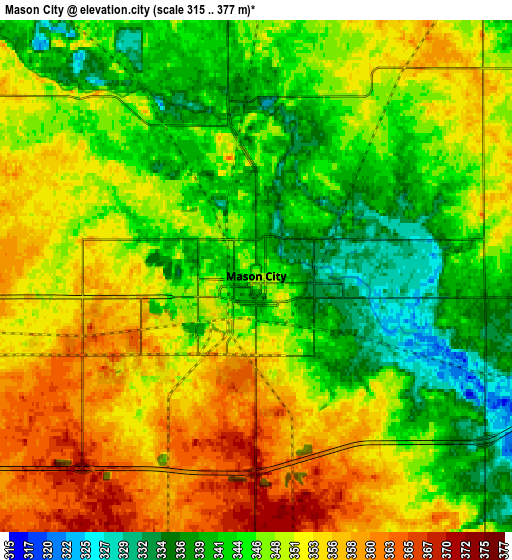
Below is the Elevation map of Mason City, which displays elevation range with different colors. Scale of the first map is from 323 to 368 m (1060 to 1207 ft) with average elevation of 343.9 meters (=1128 ft) [note 1]
These maps also provides idea of topography and contour of this city, they are displayed at different zoom levels. More info about maps, scale and edge coordinates you can find below images.
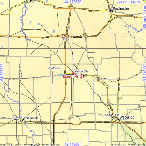
| \ | Map #1 | Map #2 | Topo.Map |
| Scale [m] | 323..368 m | 315..377 m | × |
| Scale [ft] | 1060..1207 ft | 1033..1237 ft | × |
| Average | 343.9 m = 1128 ft | 348.1 m = 1142 ft | × |
| Width | 7.13 km = 4.4 mi | 14.26 km = 8.9 mi | 228.1 km = 141.7 mi |
| Height | 7.13 km = 4.4 mi | 14.26 km = 8.9 mi | 228.1 km = 141.7 mi |
| ↑Max Latitude | 43.185621° | 43.217655° | 44.17085° |
| Latitude at center | 43.15357° | 43.15357° | 43.15357° |
| ↓Min Latitude | 43.121502° | 43.089418° | 42.11907° |
| ← Min Longitude | -93.244985° | -93.288931° | -94.60729° |
| Longitude center | -93.20104° | -93.20104° | -93.20104° |
| →Max Longitude | -93.157095° | -93.113149° | -91.79479° |
Nearby cities:
Cities around Mason City sort by population:
• Clear Lake elevation 376 m
14.6 km,  263°
263°
• Forest City 386 m
37.4 km,  288°
288°
• Osage 361 m
34.8 km,  65°
65°
• Garner 368 m
33 km, 260°
• Lake Mills 392 m
40 km,  317°
317°
• Northwood 377 m
32.3 km,  357°
357°
• Nora Springs 333 m
16 km,  94°
94°
• Manly 367 m
14.9 km, 359°
• Sheffield 328 m
29 km,  182°
182°
• Greene 292 m
43.3 km,  131°
131°
• Saint Ansgar 356 m
33.9 km,  42°
42°
• Rockwell 339 m
18.7 km, 177°
Multilingual:
 En español:
Mason City elevación 348 m.
 En France:
Mason City élévation 348 m.
 Auf Deutsch:
Mason City höhe über dem Meeresspiegel ist 348 m.

Sources and notes:
- [note 1] Map square and city borders are not equal. Map elevation data is calculated only from area inside that square.
- [src 1] Elevation data from geonames database provided with same terms of usage.
- [src 2] The elevation map of Mason City is generated using elevation data from NASA's 3 arcsec (90m) resolution SRTM data.
- [src 3] Base (background) map © OpenStreetMap contributors tiles are generated by Geofabrik and OpenTopoMap.
Copyright & License:
This Mason City Elevation Map is licensed under CC BY-SA. You may reuse any part from this page, if you give a proper credit by linking to this URL:
 More info on terms of use page.