Saint Ansgar elevation
Saint Ansgar (Iowa, Mitchell County), United States elevation is 356 meters and Saint Ansgar elevation in feet is 1168 ft above sea level [src 1]. Saint Ansgar is a populated place (feature code) with elevation that is 77 meters (253 ft) bigger than average city elevation in United States.
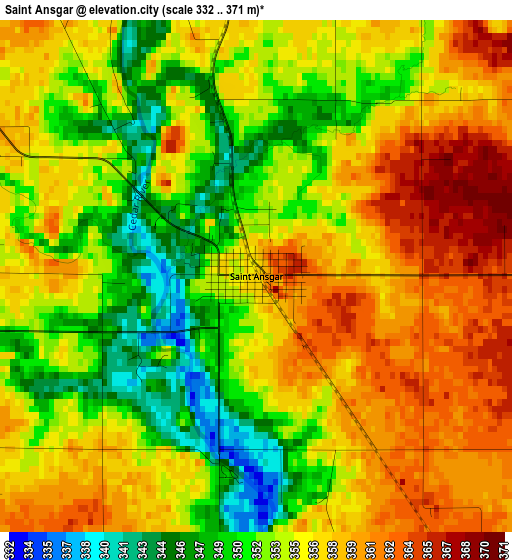
Below is the Elevation map of Saint Ansgar, which displays elevation range with different colors. Scale of the first map is from 332 to 371 m (1089 to 1217 ft) with average elevation of 354.6 meters (=1163 ft) [note 1]
These maps also provides idea of topography and contour of this city, they are displayed at different zoom levels. More info about maps, scale and edge coordinates you can find below images.
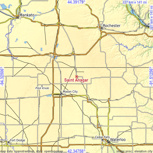
| \ | Map #1 | Topo.Map |
| Scale [m] | 332..371 m | × |
| Scale [ft] | 1089..1217 ft | × |
| Average | 354.6 m = 1163 ft | × |
| Width | 7.1 km = 4.4 mi | 227.3 km = 141.2 mi |
| Height | 7.1 km = 4.4 mi | 227.3 km = 141.2 mi |
| ↑Max Latitude | 43.410233° | 44.39179° |
| Latitude at center | 43.3783° | 43.3783° |
| ↓Min Latitude | 43.346351° | 42.34758° |
| ← Min Longitude | -92.962755° | -94.32506° |
| Longitude center | -92.91881° | -92.91881° |
| →Max Longitude | -92.874865° | -91.51256° |
Nearby cities:
Cities around Saint Ansgar sort by population:
• Mason City elevation 348 m
33.9 km,  222°
222°
• Austin 370 m
32.4 km,  352°
352°
• Albert Lea 382 m
47 km,  309°
309°
• Clear Lake 376 m
45.9 km,  234°
234°
• Charles City 307 m
40 km,  150°
150°
• Osage 361 m
13.6 km,  140°
140°
• Lake Mills 392 m
49.9 km,  275°
275°
• Northwood 377 m
25.5 km,  286°
286°
• Nora Springs 333 m
27.1 km,  194°
194°
• Manly 367 m
25.1 km,  246°
246°
• Grand Meadow 413 m
45.9 km,  37°
37°
• Rockwell 339 m
49 km,  206°
206°
Multilingual:
 En español:
Saint Ansgar elevación 356 m.
 En France:
Saint Ansgar élévation 356 m.
 Auf Deutsch:
Saint Ansgar höhe über dem Meeresspiegel ist 356 m.

Sources and notes:
- [note 1] Map square and city borders are not equal. Map elevation data is calculated only from area inside that square.
- [src 1] Elevation data from geonames database provided with same terms of usage.
- [src 2] The elevation map of Saint Ansgar is generated using elevation data from NASA's 3 arcsec (90m) resolution SRTM data.
- [src 3] Base (background) map © OpenStreetMap contributors tiles are generated by Geofabrik and OpenTopoMap.
Copyright & License:
This Saint Ansgar Elevation Map is licensed under CC BY-SA. You may reuse any part from this page, if you give a proper credit by linking to this URL:
 More info on terms of use page.