West Simsbury elevation
West Simsbury (Connecticut, Hartford County), United States elevation is 99 meters and West Simsbury elevation in feet is 325 ft above sea level [src 1]. West Simsbury is a populated place (feature code) with elevation that is 180 meters (591 ft) smaller than average city elevation in United States.
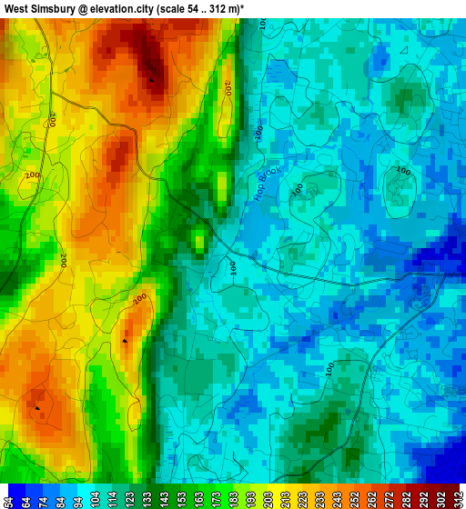
Below is the Elevation map of West Simsbury, which displays elevation range with different colors. Scale of the first map is from 54 to 312 m (177 to 1024 ft) with average elevation of 145 meters (=476 ft) [note 1]
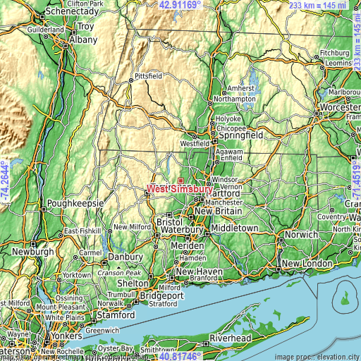
These maps also provides idea of topography and contour of this city, they are displayed at different zoom levels. More info about maps, scale and edge coordinates you can find below images.
| \ | Map #1 | Topo.Map |
| Scale [m] | 54..312 m | × |
| Scale [ft] | 177..1024 ft | × |
| Average | 145 m = 476 ft | × |
| Width | 7.28 km = 4.5 mi | 232.9 km = 144.7 mi |
| Height | 7.28 km = 4.5 mi | 232.8 km = 144.7 mi |
| ↑Max Latitude | 41.905864° | 42.91169° |
| Latitude at center | 41.87315° | 41.87315° |
| ↓Min Latitude | 41.840419° | 40.81746° |
| ← Min Longitude | -72.902095° | -74.2644° |
| Longitude center | -72.85815° | -72.85815° |
| →Max Longitude | -72.814205° | -71.4519° |
Nearby cities:
Cities around West Simsbury sort by population:
• West Hartford elevation 41 m
15.7 km,  142°
142°
• Farmington 80 m
17.2 km,  172°
172°
• Winsted 218 m
17.5 km,  287°
287°
• Simsbury Center 87 m
4 km,  77°
77°
• Collinsville 103 m
8.4 km,  217°
217°
• Blue Hills 45 m
14.9 km,  116°
116°
• Weatogue 93 m
4.1 km, 143°
• Salmon Brook 71 m
10.6 km,  29°
29°
• North Granby 86 m
13.9 km,  9°
9°
• Canton Valley 209 m
5.1 km,  212°
212°
• New Hartford Center 130 m
9.7 km,  274°
274°
• Tariffville 55 m
9 km,  64°
64°
Multilingual:
 En español:
West Simsbury elevación 99 m.
 En France:
West Simsbury élévation 99 m.
 Auf Deutsch:
West Simsbury höhe über dem Meeresspiegel ist 99 m.

Sources and notes:
- [note 1] Map square and city borders are not equal. Map elevation data is calculated only from area inside that square.
- [src 1] Elevation data from geonames database provided with same terms of usage.
- [src 2] The elevation map of West Simsbury is generated using elevation data from NASA's 3 arcsec (90m) resolution SRTM data.
- [src 3] Base (background) map © OpenStreetMap contributors tiles are generated by Geofabrik and OpenTopoMap.
Copyright & License:
This West Simsbury Elevation Map is licensed under CC BY-SA. You may reuse any part from this page, if you give a proper credit by linking to this URL:
 More info on terms of use page.