Stafford Springs elevation
Stafford Springs (Connecticut, Tolland County), United States elevation is 153 meters and Stafford Springs elevation in feet is 502 ft above sea level [src 1]. Stafford Springs is a populated place (feature code) with elevation that is 126 meters (413 ft) smaller than average city elevation in United States.
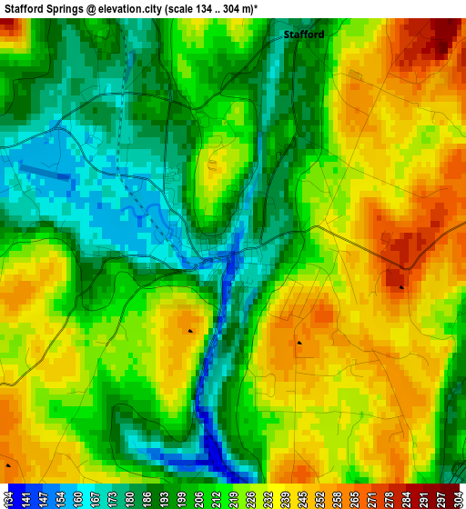
Below is the Elevation map of Stafford Springs, which displays elevation range with different colors. Scale of the first map is from 134 to 304 m (440 to 997 ft) with average elevation of 214.3 meters (=703 ft) [note 1]
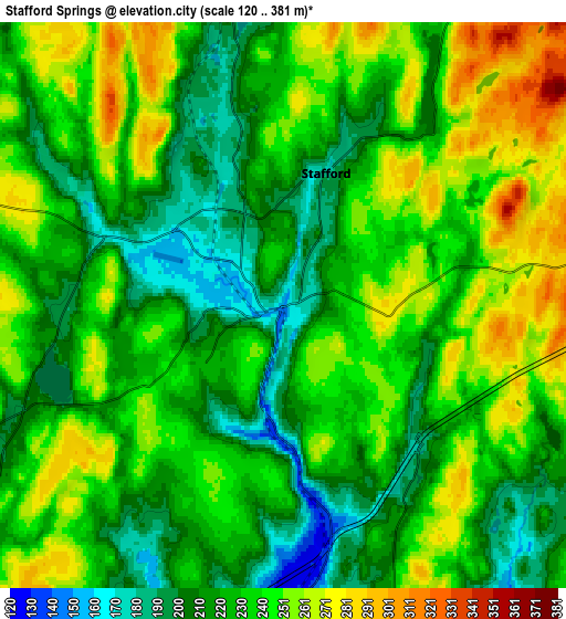
These maps also provides idea of topography and contour of this city, they are displayed at different zoom levels. More info about maps, scale and edge coordinates you can find below images.
| \ | Map #1 | Map #2 | Topo.Map |
| Scale [m] | 134..304 m | 120..381 m | × |
| Scale [ft] | 440..997 ft | 394..1250 ft | × |
| Average | 214.3 m = 703 ft | 232.7 m = 763 ft | × |
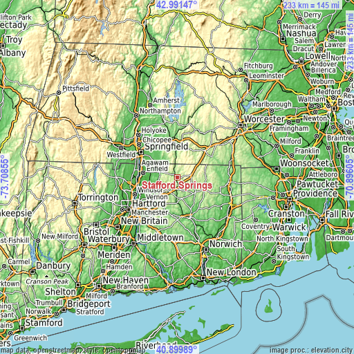
| Width | 7.27 km = 4.5 mi | 14.54 km = 9 mi | 232.6 km = 144.5 mi |
| Height | 7.27 km = 4.5 mi | 14.54 km = 9 mi | 232.6 km = 144.5 mi |
| ↑Max Latitude | 41.986933° | 42.019589° | 42.99147° |
| Latitude at center | 41.95426° | 41.95426° | 41.95426° |
| ↓Min Latitude | 41.92157° | 41.888864° | 40.89989° |
| ← Min Longitude | -72.346245° | -72.390191° | -73.70855° |
| Longitude center | -72.3023° | -72.3023° | -72.3023° |
| →Max Longitude | -72.258355° | -72.214409° | -70.89605° |
Nearby cities:
Cities around Stafford Springs sort by population:
• Storrs elevation 192 m
16.8 km,  164°
164°
• Tolland 207 m
10.7 km,  210°
210°
• Ellington 80 m
14.9 km,  248°
248°
• Stafford 181 m
3.6 km,  17°
17°
• Monson 138 m
16.7 km,  355°
355°
• Rockville 120 m
15.6 km,  231°
231°
• Hampden 100 m
15.3 km,  323°
323°
• Monson Center 174 m
16.1 km, 359°
• Crystal Lake 213 m
6.8 km, 248°
• Somers 79 m
12.4 km,  286°
286°
• Wales 294 m
14.4 km,  27°
27°
• Holland 227 m
17.1 km,  44°
44°
Multilingual:
 En español:
Stafford Springs elevación 153 m.
 En France:
Stafford Springs élévation 153 m.
 Auf Deutsch:
Stafford Springs höhe über dem Meeresspiegel ist 153 m.

Sources and notes:
- [note 1] Map square and city borders are not equal. Map elevation data is calculated only from area inside that square.
- [src 1] Elevation data from geonames database provided with same terms of usage.
- [src 2] The elevation map of Stafford Springs is generated using elevation data from NASA's 3 arcsec (90m) resolution SRTM data.
- [src 3] Base (background) map © OpenStreetMap contributors tiles are generated by Geofabrik and OpenTopoMap.
Copyright & License:
This Stafford Springs Elevation Map is licensed under CC BY-SA. You may reuse any part from this page, if you give a proper credit by linking to this URL:
 More info on terms of use page.