Mansfield City elevation
Mansfield City (Connecticut, Tolland County), United States elevation is 154 meters and Mansfield City elevation in feet is 505 ft above sea level [src 1]. Mansfield City is a populated place (feature code) with elevation that is 125 meters (410 ft) smaller than average city elevation in United States.
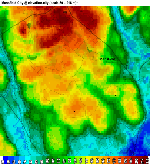
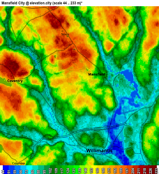
Below is the Elevation map of Mansfield City, which displays elevation range with different colors. Scale of the first map is from 50 to 218 m (164 to 715 ft) with average elevation of 131.2 meters (=430 ft) [note 1]
These maps also provides idea of topography and contour of this city, they are displayed at different zoom levels. More info about maps, scale and edge coordinates you can find below images.
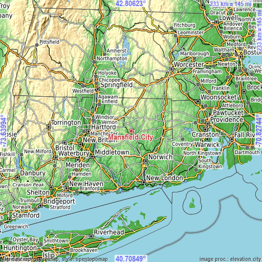
| \ | Map #1 | Map #2 | Topo.Map |
| Scale [m] | 50..218 m | 44..233 m | × |
| Scale [ft] | 164..715 ft | 144..764 ft | × |
| Average | 131.2 m = 430 ft | 130.9 m = 429 ft | × |
| Width | 7.29 km = 4.5 mi | 14.58 km = 9.1 mi | 233.2 km = 144.9 mi |
| Height | 7.29 km = 4.5 mi | 14.58 km = 9.1 mi | 233.2 km = 144.9 mi |
| ↑Max Latitude | 41.798699° | 41.831452° | 42.80623° |
| Latitude at center | 41.76593° | 41.76593° | 41.76593° |
| ↓Min Latitude | 41.733144° | 41.700341° | 40.70849° |
| ← Min Longitude | -72.277635° | -72.321581° | -73.63994° |
| Longitude center | -72.23369° | -72.23369° | -72.23369° |
| →Max Longitude | -72.189745° | -72.145799° | -70.82744° |
Nearby cities:
Cities around Mansfield City sort by population:
• Windham elevation 89 m
9.7 km,  139°
139°
• Willimantic 67 m
6.5 km,  160°
160°
• Storrs 192 m
4.9 km,  344°
344°
• Tolland 207 m
16.2 km,  316°
316°
• Hebron 169 m
16.3 km,  222°
222°
• Rockville 120 m
21.1 km,  302°
302°
• Stafford Springs 153 m
21.7 km, 344°
• Coventry Lake 159 m
8.2 km,  274°
274°
• Crystal Lake 213 m
22 km,  326°
326°
• South Coventry 160 m
5.9 km, 274°
• South Windham 54 m
10.9 km,  151°
151°
• Baltic 26 m
20.7 km, 143°
Multilingual:
 En español:
Mansfield City elevación 154 m.
 En France:
Mansfield City élévation 154 m.
 Auf Deutsch:
Mansfield City höhe über dem Meeresspiegel ist 154 m.

Sources and notes:
- [note 1] Map square and city borders are not equal. Map elevation data is calculated only from area inside that square.
- [src 1] Elevation data from geonames database provided with same terms of usage.
- [src 2] The elevation map of Mansfield City is generated using elevation data from NASA's 3 arcsec (90m) resolution SRTM data.
- [src 3] Base (background) map © OpenStreetMap contributors tiles are generated by Geofabrik and OpenTopoMap.
Copyright & License:
This Mansfield City Elevation Map is licensed under CC BY-SA. You may reuse any part from this page, if you give a proper credit by linking to this URL:
 More info on terms of use page.