Auburn elevation
Auburn (Alabama, Lee County), United States elevation is 220 meters and Auburn elevation in feet is 722 ft above sea level [src 1]. Auburn is a populated place (feature code) with elevation that is 59 meters (194 ft) smaller than average city elevation in United States.
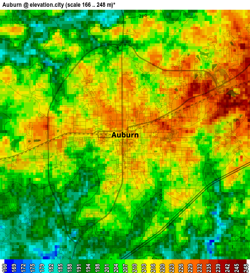
Below is the Elevation map of Auburn, which displays elevation range with different colors. Scale of the first map is from 166 to 248 m (545 to 814 ft) with average elevation of 208.1 meters (=683 ft) [note 1]
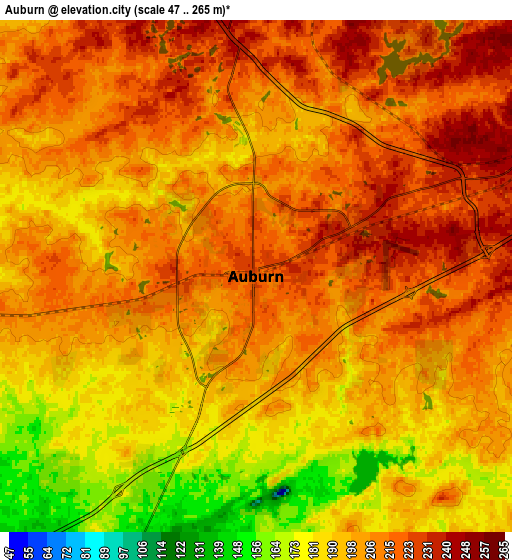
These maps also provides idea of topography and contour of this city, they are displayed at different zoom levels. More info about maps, scale and edge coordinates you can find below images.
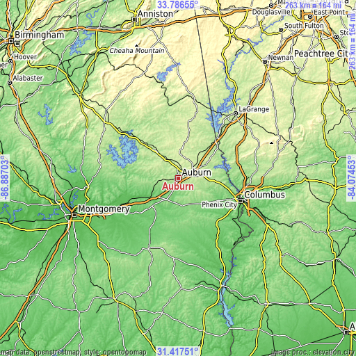
| \ | Map #1 | Map #2 | Topo.Map |
| Scale [m] | 166..248 m | 47..265 m | × |
| Scale [ft] | 545..814 ft | 154..869 ft | × |
| Average | 208.1 m = 683 ft | 202.5 m = 664 ft | × |
| Width | 8.23 km = 5.1 mi | 16.46 km = 10.2 mi | 263.4 km = 163.7 mi |
| Height | 8.23 km = 5.1 mi | 16.46 km = 10.2 mi | 263.4 km = 163.7 mi |
| ↑Max Latitude | 32.64687° | 32.683865° | 33.78655° |
| Latitude at center | 32.60986° | 32.60986° | 32.60986° |
| ↓Min Latitude | 32.572835° | 32.535794° | 31.41751° |
| ← Min Longitude | -85.524725° | -85.568671° | -86.88703° |
| Longitude center | -85.48078° | -85.48078° | -85.48078° |
| →Max Longitude | -85.436835° | -85.392889° | -84.07453° |
Nearby cities:
Cities around Auburn sort by population:
• Phenix City elevation 80 m
47.6 km,  108°
108°
• Opelika 254 m
10.4 km,  67°
67°
• Valley 184 m
36.5 km,  50°
50°
• Tuskegee 147 m
28.5 km,  223°
223°
• Lanett 182 m
39.6 km,  43°
43°
• Smiths Station 165 m
36.6 km,  102°
102°
• Tallassee 123 m
39.5 km,  257°
257°
• West Point 178 m
40.8 km, 43°
• Dadeville 224 m
36.1 km,  312°
312°
• Ladonia 149 m
40.8 km, 112°
• Lafayette 264 m
33.1 km,  13°
13°
• Huguley 216 m
34.3 km, 43°
Multilingual:
 En español:
Auburn elevación 220 m.
 En France:
Auburn élévation 220 m.


Sources and notes:
- [note 1] Map square and city borders are not equal. Map elevation data is calculated only from area inside that square.
- [src 1] Elevation data from geonames database provided with same terms of usage.
- [src 2] The elevation map of Auburn is generated using elevation data from NASA's 3 arcsec (90m) resolution SRTM data.
- [src 3] Base (background) map © OpenStreetMap contributors tiles are generated by Geofabrik and OpenTopoMap.
Copyright & License:
This Auburn Elevation Map is licensed under CC BY-SA. You may reuse any part from this page, if you give a proper credit by linking to this URL:
 More info on terms of use page.