Atmore elevation
Atmore (Alabama, Escambia County), United States elevation is 89 meters and Atmore elevation in feet is 292 ft above sea level [src 1]. Atmore is a populated place (feature code) with elevation that is 190 meters (623 ft) smaller than average city elevation in United States.
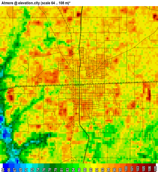
Below is the Elevation map of Atmore, which displays elevation range with different colors. Scale of the first map is from 64 to 108 m (210 to 354 ft) with average elevation of 90 meters (=295 ft) [note 1]
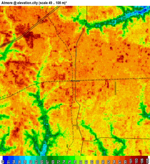
These maps also provides idea of topography and contour of this city, they are displayed at different zoom levels. More info about maps, scale and edge coordinates you can find below images.
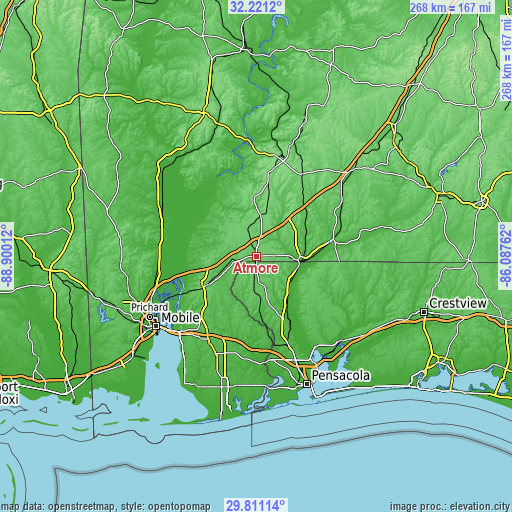
| \ | Map #1 | Map #2 | Topo.Map |
| Scale [m] | 64..108 m | 49..108 m | × |
| Scale [ft] | 210..354 ft | 161..354 ft | × |
| Average | 90 m = 295 ft | 87.8 m = 288 ft | × |
| Width | 8.37 km = 5.2 mi | 16.75 km = 10.4 mi | 268 km = 166.5 mi |
| Height | 8.37 km = 5.2 mi | 16.75 km = 10.4 mi | 268 km = 166.5 mi |
| ↑Max Latitude | 31.061442° | 31.099078° | 32.2212° |
| Latitude at center | 31.02379° | 31.02379° | 31.02379° |
| ↓Min Latitude | 30.986123° | 30.948442° | 29.81114° |
| ← Min Longitude | -87.537815° | -87.581761° | -88.90012° |
| Longitude center | -87.49387° | -87.49387° | -87.49387° |
| →Max Longitude | -87.449925° | -87.405979° | -86.08762° |
Nearby cities:
Cities around Atmore sort by population:
• Cantonment elevation 50 m
48.5 km,  162°
162°
• Gonzalez 57 m
52.8 km, 158°
• Bay Minette 85 m
30.9 km,  239°
239°
• Brewton 28 m
41.2 km,  77°
77°
• East Brewton 34 m
41.8 km, 79°
• Loxley 56 m
51.4 km,  208°
208°
• Wallace 65 m
48.8 km,  142°
142°
• Century 35 m
22.6 km,  104°
104°
• Mount Vernon 16 m
49.9 km,  277°
277°
• Flomaton 27 m
22.4 km, 96°
• Molino 19 m
37.5 km,  152°
152°
• Frisco City 127 m
46.4 km,  10°
10°
Multilingual:
 En español:
Atmore elevación 89 m.
 En France:
Atmore élévation 89 m.


Sources and notes:
- [note 1] Map square and city borders are not equal. Map elevation data is calculated only from area inside that square.
- [src 1] Elevation data from geonames database provided with same terms of usage.
- [src 2] The elevation map of Atmore is generated using elevation data from NASA's 3 arcsec (90m) resolution SRTM data.
- [src 3] Base (background) map © OpenStreetMap contributors tiles are generated by Geofabrik and OpenTopoMap.
Copyright & License:
This Atmore Elevation Map is licensed under CC BY-SA. You may reuse any part from this page, if you give a proper credit by linking to this URL:
 More info on terms of use page.