Brewton elevation
Brewton (Alabama, Escambia County), United States elevation is 28 meters and Brewton elevation in feet is 92 ft above sea level [src 1]. Brewton is a seat of a second-order administrative division (feature code) with elevation that is 251 meters (823 ft) smaller than average city elevation in United States.
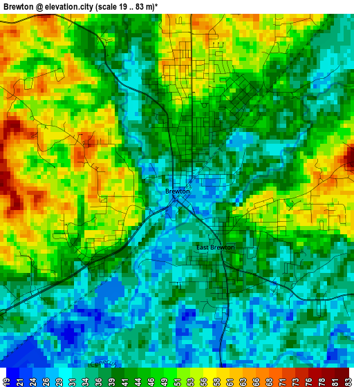
Below is the Elevation map of Brewton, which displays elevation range with different colors. Scale of the first map is from 19 to 83 m (62 to 272 ft) with average elevation of 43 meters (=141 ft) [note 1]
These maps also provides idea of topography and contour of this city, they are displayed at different zoom levels. More info about maps, scale and edge coordinates you can find below images.
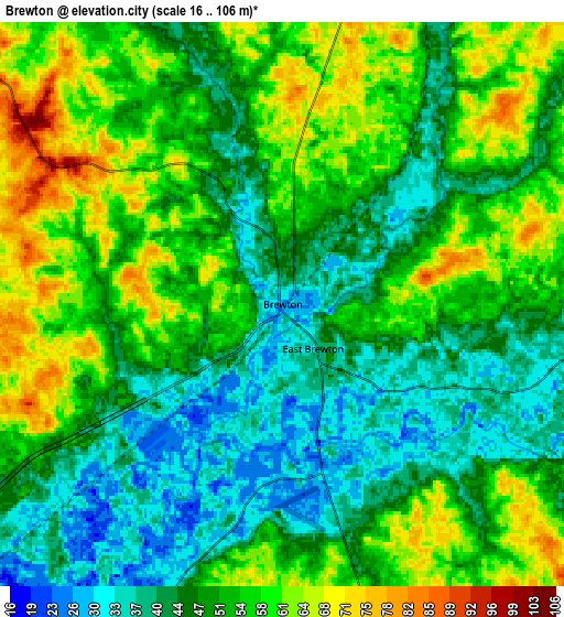
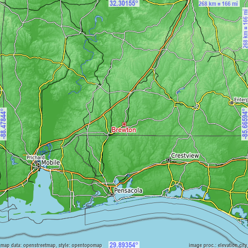
| \ | Map #1 | Map #2 | Topo.Map |
| Scale [m] | 19..83 m | 16..106 m | × |
| Scale [ft] | 62..272 ft | 52..348 ft | × |
| Average | 43 m = 141 ft | 50.5 m = 166 ft | × |
| Width | 8.37 km = 5.2 mi | 16.73 km = 10.4 mi | 267.7 km = 166.3 mi |
| Height | 8.37 km = 5.2 mi | 16.73 km = 10.4 mi | 267.8 km = 166.4 mi |
| ↑Max Latitude | 31.142799° | 31.180404° | 32.30155° |
| Latitude at center | 31.10518° | 31.10518° | 31.10518° |
| ↓Min Latitude | 31.067546° | 31.029896° | 29.89354° |
| ← Min Longitude | -87.116135° | -87.160081° | -88.47844° |
| Longitude center | -87.07219° | -87.07219° | -87.07219° |
| →Max Longitude | -87.028245° | -86.984299° | -85.66594° |
Nearby cities:
Cities around Brewton sort by population:
• East Milton elevation 10 m
54.7 km,  174°
174°
• Atmore 89 m
41.2 km,  257°
257°
• Milton 14 m
52.7 km,  176°
176°
• Monroeville 131 m
52.8 km,  332°
332°
• Evergreen 90 m
38.1 km,  16°
16°
• Point Baker 64 m
46.2 km, 177°
• East Brewton 34 m
1.6 km,  145°
145°
• Wallace 65 m
48.7 km,  192°
192°
• Century 35 m
23.4 km,  231°
231°
• Flomaton 27 m
21.4 km,  236°
236°
• Molino 19 m
48.3 km,  208°
208°
• Frisco City 127 m
48.1 km,  319°
319°
Multilingual:
 En español:
Brewton elevación 28 m.
 En France:
Brewton élévation 28 m.


Sources and notes:
- [note 1] Map square and city borders are not equal. Map elevation data is calculated only from area inside that square.
- [src 1] Elevation data from geonames database provided with same terms of usage.
- [src 2] The elevation map of Brewton is generated using elevation data from NASA's 3 arcsec (90m) resolution SRTM data.
- [src 3] Base (background) map © OpenStreetMap contributors tiles are generated by Geofabrik and OpenTopoMap.
Copyright & License:
This Brewton Elevation Map is licensed under CC BY-SA. You may reuse any part from this page, if you give a proper credit by linking to this URL:
 More info on terms of use page.