Devine elevation
Devine (Texas, Medina County), United States elevation is 200 meters and Devine elevation in feet is 656 ft above sea level [src 1]. Devine is a populated place (feature code) with elevation that is 79 meters (259 ft) smaller than average city elevation in United States.
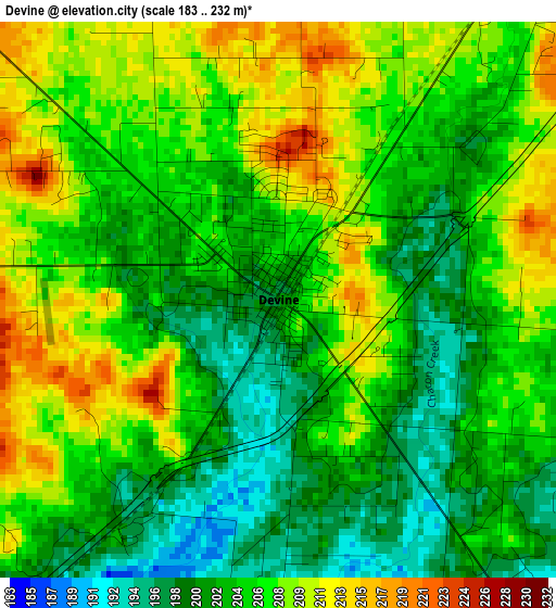
Below is the Elevation map of Devine, which displays elevation range with different colors. Scale of the first map is from 183 to 232 m (600 to 761 ft) with average elevation of 205 meters (=673 ft) [note 1]
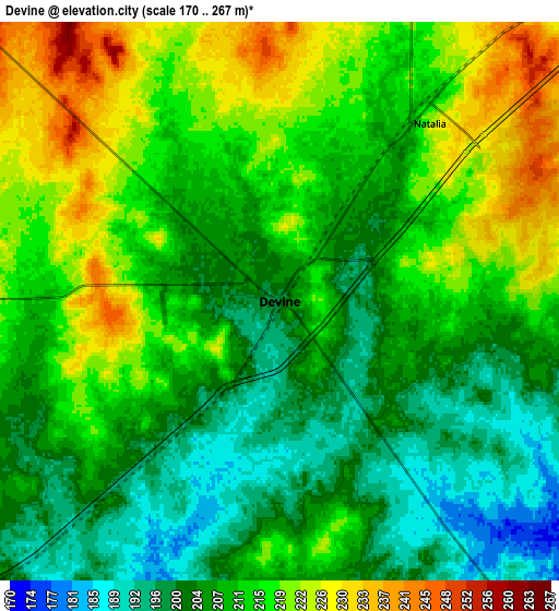
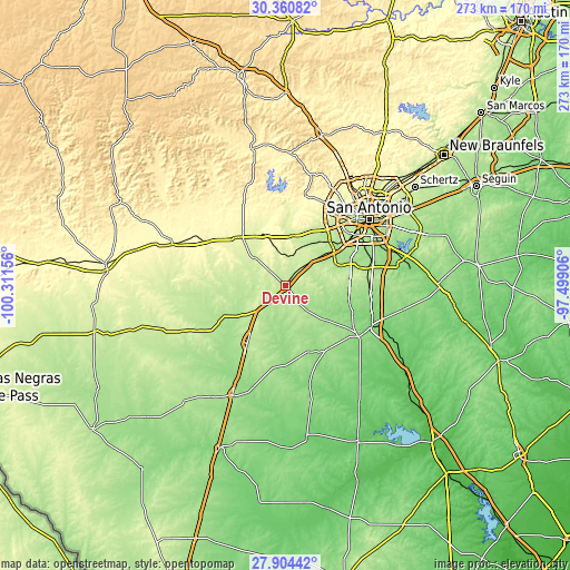
These maps also provides idea of topography and contour of this city, they are displayed at different zoom levels. More info about maps, scale and edge coordinates you can find below images.
| \ | Map #1 | Map #2 | Topo.Map |
| Scale [m] | 183..232 m | 170..267 m | × |
| Scale [ft] | 600..761 ft | 558..876 ft | × |
| Average | 205 m = 673 ft | 210.8 m = 692 ft | × |
| Width | 8.54 km = 5.3 mi | 17.07 km = 10.6 mi | 273.1 km = 169.7 mi |
| Height | 8.54 km = 5.3 mi | 17.07 km = 10.6 mi | 273.1 km = 169.7 mi |
| ↑Max Latitude | 29.178336° | 29.216698° | 30.36082° |
| Latitude at center | 29.13996° | 29.13996° | 29.13996° |
| ↓Min Latitude | 29.10157° | 29.063165° | 27.90442° |
| ← Min Longitude | -98.949255° | -98.993201° | -100.31156° |
| Longitude center | -98.90531° | -98.90531° | -98.90531° |
| →Max Longitude | -98.861365° | -98.817419° | -97.49906° |
Nearby cities:
Cities around Devine sort by population:
• Pearsall elevation 193 m
33.2 km,  213°
213°
• Lackland Air Force Base 230 m
39.1 km,  45°
45°
• Hondo 274 m
32.5 km,  315°
315°
• Jourdanton 143 m
42.7 km,  125°
125°
• Poteet 139 m
34.6 km,  108°
108°
• Castroville 234 m
24.1 km,  6°
6°
• Lytle 223 m
14.8 km, 45°
• Charlotte 167 m
36.5 km,  147°
147°
• Somerset 199 m
25.9 km,  68°
68°
• Natalia 211 m
6.9 km,  36°
36°
• Von Ormy 182 m
30.3 km,  56°
56°
• La Coste 222 m
21.1 km,  25°
25°
Multilingual:
 En español:
Devine elevación 200 m.
 En France:
Devine élévation 200 m.


Sources and notes:
- [note 1] Map square and city borders are not equal. Map elevation data is calculated only from area inside that square.
- [src 1] Elevation data from geonames database provided with same terms of usage.
- [src 2] The elevation map of Devine is generated using elevation data from NASA's 3 arcsec (90m) resolution SRTM data.
- [src 3] Base (background) map © OpenStreetMap contributors tiles are generated by Geofabrik and OpenTopoMap.
Copyright & License:
This Devine Elevation Map is licensed under CC BY-SA. You may reuse any part from this page, if you give a proper credit by linking to this URL:
 More info on terms of use page.