Clay elevation
Clay (West Virginia, Clay County), United States elevation is 216 meters and Clay elevation in feet is 709 ft above sea level [src 1]. Clay is a seat of a second-order administrative division (feature code) with elevation that is 63 meters (207 ft) smaller than average city elevation in United States.
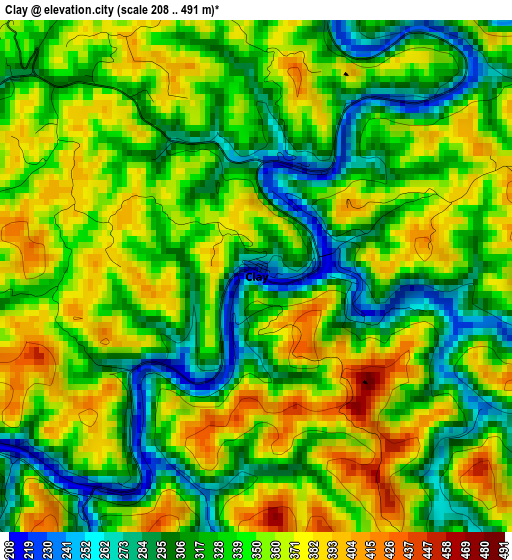
Below is the Elevation map of Clay, which displays elevation range with different colors. Scale of the first map is from 208 to 491 m (682 to 1611 ft) with average elevation of 339.5 meters (=1114 ft) [note 1]
These maps also provides idea of topography and contour of this city, they are displayed at different zoom levels. More info about maps, scale and edge coordinates you can find below images.
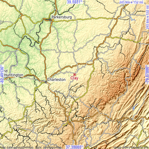
| \ | Map #1 | Topo.Map |
| Scale [m] | 208..491 m | × |
| Scale [ft] | 682..1611 ft | × |
| Average | 339.5 m = 1114 ft | × |
| Width | 7.65 km = 4.8 mi | 244.9 km = 152.2 mi |
| Height | 7.65 km = 4.8 mi | 244.9 km = 152.2 mi |
| ↑Max Latitude | 38.494783° | 39.5531° |
| Latitude at center | 38.46038° | 38.46038° |
| ↓Min Latitude | 38.425961° | 37.35085° |
| ← Min Longitude | -81.129055° | -82.49136° |
| Longitude center | -81.08511° | -81.08511° |
| →Max Longitude | -81.041165° | -79.67886° |
Nearby cities:
Cities around Clay sort by population:
• Summersville elevation 573 m
28.4 km,  134°
134°
• Pinch 223 m
35 km,  260°
260°
• Fayetteville 551 m
45.3 km,  182°
182°
• Craigsville 704 m
40.3 km,  110°
110°
• Spencer 231 m
44.5 km,  328°
328°
• Rand 193 m
46.1 km,  244°
244°
• Montgomery 195 m
37.7 km,  214°
214°
• Ansted 403 m
36.1 km, 182°
• Coal Fork 195 m
41.2 km,  247°
247°
• Elkview 185 m
34.5 km,  266°
266°
• Clendenin 205 m
23.1 km,  277°
277°
• Sutton 254 m
39.7 km,  55°
55°
Multilingual:
 En español:
Clay elevación 216 m.
 En France:
Clay élévation 216 m.


Sources and notes:
- [note 1] Map square and city borders are not equal. Map elevation data is calculated only from area inside that square.
- [src 1] Elevation data from geonames database provided with same terms of usage.
- [src 2] The elevation map of Clay is generated using elevation data from NASA's 3 arcsec (90m) resolution SRTM data.
- [src 3] Base (background) map © OpenStreetMap contributors tiles are generated by Geofabrik and OpenTopoMap.
Copyright & License:
This Clay Elevation Map is licensed under CC BY-SA. You may reuse any part from this page, if you give a proper credit by linking to this URL:
 More info on terms of use page.