Rocky Mount elevation
Rocky Mount (Virginia, Franklin County), United States elevation is 347 meters and Rocky Mount elevation in feet is 1138 ft above sea level [src 1]. Rocky Mount is a seat of a second-order administrative division (feature code) with elevation that is 68 meters (223 ft) bigger than average city elevation in United States.
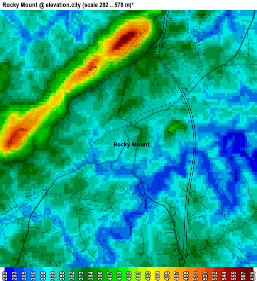
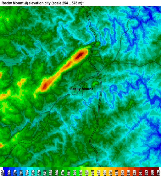
Below is the Elevation map of Rocky Mount, which displays elevation range with different colors. Scale of the first map is from 282 to 578 m (925 to 1896 ft) with average elevation of 353.9 meters (=1161 ft) [note 1]
These maps also provides idea of topography and contour of this city, they are displayed at different zoom levels. More info about maps, scale and edge coordinates you can find below images.
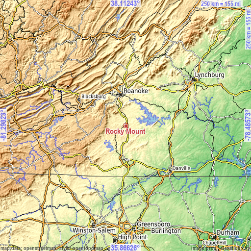
| \ | Map #1 | Map #2 | Topo.Map |
| Scale [m] | 282..578 m | 254..578 m | × |
| Scale [ft] | 925..1896 ft | 833..1896 ft | × |
| Average | 353.9 m = 1161 ft | 344.4 m = 1130 ft | × |
| Width | 7.8 km = 4.8 mi | 15.61 km = 9.7 mi | 249.8 km = 155.2 mi |
| Height | 7.8 km = 4.8 mi | 15.61 km = 9.7 mi | 249.7 km = 155.2 mi |
| ↑Max Latitude | 37.032729° | 37.067802° | 38.11243° |
| Latitude at center | 36.99764° | 36.99764° | 36.99764° |
| ↓Min Latitude | 36.962535° | 36.927413° | 35.86626° |
| ← Min Longitude | -79.935925° | -79.979871° | -81.29823° |
| Longitude center | -79.89198° | -79.89198° | -79.89198° |
| →Max Longitude | -79.848035° | -79.804089° | -78.48573° |
Nearby cities:
Cities around Rocky Mount sort by population:
• Roanoke elevation 296 m
30.7 km,  351°
351°
• Cave Spring 338 m
27.7 km,  337°
337°
• Vinton 280 m
31.5 km,  359°
359°
• Collinsville 246 m
31.5 km,  183°
183°
• North Shore 308 m
22.8 km,  65°
65°
• Narrows 373 m
23.9 km, 345°
• Ferrum 396 m
13.6 km,  232°
232°
• Stanleytown 233 m
28.9 km,  192°
192°
• Henry Fork 375 m
4 km,  151°
151°
• Union Hall 275 m
18.4 km,  82°
82°
• Bassett 234 m
27.9 km,  198°
198°
• Cedar Bluff 299 m
29.9 km, 352°
Multilingual:
 En español:
Rocky Mount elevación 347 m.
 En France:
Rocky Mount élévation 347 m.
 Auf Deutsch:
Rocky Mount höhe über dem Meeresspiegel ist 347 m.

Sources and notes:
- [note 1] Map square and city borders are not equal. Map elevation data is calculated only from area inside that square.
- [src 1] Elevation data from geonames database provided with same terms of usage.
- [src 2] The elevation map of Rocky Mount is generated using elevation data from NASA's 3 arcsec (90m) resolution SRTM data.
- [src 3] Base (background) map © OpenStreetMap contributors tiles are generated by Geofabrik and OpenTopoMap.
Copyright & License:
This Rocky Mount Elevation Map is licensed under CC BY-SA. You may reuse any part from this page, if you give a proper credit by linking to this URL:
 More info on terms of use page.