Roanoke elevation
Roanoke (Virginia, City of Roanoke), United States elevation is 296 meters and Roanoke elevation in feet is 971 ft above sea level [src 1]. Roanoke is a seat of a second-order administrative division (feature code) with elevation that is 17 meters (56 ft) bigger than average city elevation in United States.
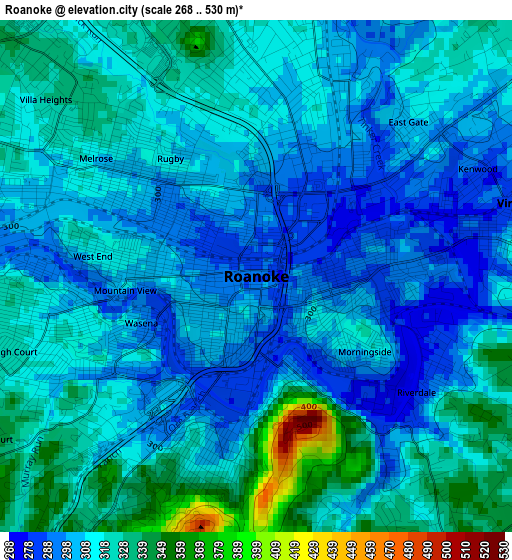
Below is the Elevation map of Roanoke, which displays elevation range with different colors. Scale of the first map is from 268 to 530 m (879 to 1739 ft) with average elevation of 313.2 meters (=1028 ft) [note 1]
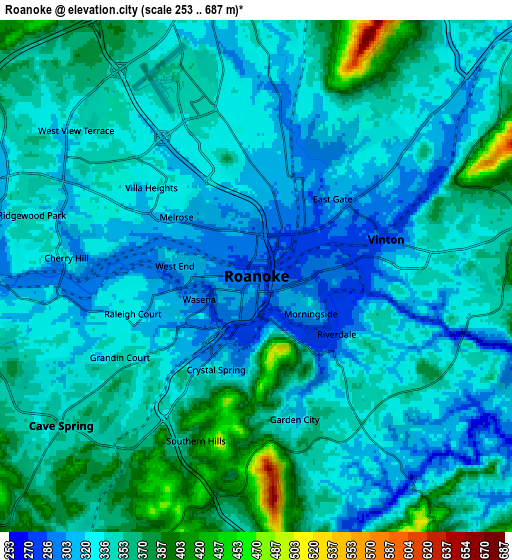
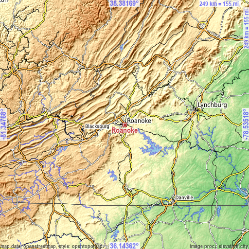
These maps also provides idea of topography and contour of this city, they are displayed at different zoom levels. More info about maps, scale and edge coordinates you can find below images.
| \ | Map #1 | Map #2 | Topo.Map |
| Scale [m] | 268..530 m | 253..687 m | × |
| Scale [ft] | 879..1739 ft | 830..2254 ft | × |
| Average | 313.2 m = 1028 ft | 340.3 m = 1116 ft | × |
| Width | 7.78 km = 4.8 mi | 15.55 km = 9.7 mi | 248.9 km = 154.7 mi |
| Height | 7.78 km = 4.8 mi | 15.55 km = 9.7 mi | 248.8 km = 154.6 mi |
| ↑Max Latitude | 37.305933° | 37.340879° | 38.38169° |
| Latitude at center | 37.27097° | 37.27097° | 37.27097° |
| ↓Min Latitude | 37.235991° | 37.200996° | 36.14362° |
| ← Min Longitude | -79.985375° | -80.029321° | -81.34768° |
| Longitude center | -79.94143° | -79.94143° | -79.94143° |
| →Max Longitude | -79.897485° | -79.853539° | -78.53518° |
Nearby cities:
Cities around Roanoke sort by population:
• Salem elevation 326 m
10.3 km,  284°
284°
• Cave Spring 338 m
7.9 km,  232°
232°
• Hollins 340 m
7.8 km,  358°
358°
• Vinton 280 m
4.1 km,  74°
74°
• Cloverdale 344 m
10.9 km,  16°
16°
• Blue Ridge 387 m
16.9 km,  44°
44°
• Daleville 395 m
15.7 km,  9°
9°
• Narrows 373 m
7.5 km,  191°
191°
• Laymantown 413 m
12.9 km, 35°
• Cedar Bluff 299 m
0.9 km,  144°
144°
• Fincastle 382 m
26 km, 12°
• New Castle 410 m
29.6 km,  329°
329°
Multilingual:
 En español:
Roanoke elevación 296 m.
 En France:
Roanoke élévation 296 m.


Sources and notes:
- [note 1] Map square and city borders are not equal. Map elevation data is calculated only from area inside that square.
- [src 1] Elevation data from geonames database provided with same terms of usage.
- [src 2] The elevation map of Roanoke is generated using elevation data from NASA's 3 arcsec (90m) resolution SRTM data.
- [src 3] Base (background) map © OpenStreetMap contributors tiles are generated by Geofabrik and OpenTopoMap.
Copyright & License:
This Roanoke Elevation Map is licensed under CC BY-SA. You may reuse any part from this page, if you give a proper credit by linking to this URL:
 More info on terms of use page.