Purcellville elevation
Purcellville (Virginia, Loudoun County), United States elevation is 172 meters and Purcellville elevation in feet is 564 ft above sea level [src 1]. Purcellville is a populated place (feature code) with elevation that is 107 meters (351 ft) smaller than average city elevation in United States.
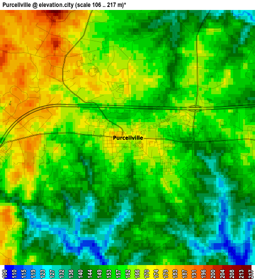
Below is the Elevation map of Purcellville, which displays elevation range with different colors. Scale of the first map is from 106 to 217 m (348 to 712 ft) with average elevation of 155.8 meters (=511 ft) [note 1]
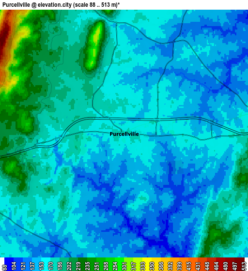
These maps also provides idea of topography and contour of this city, they are displayed at different zoom levels. More info about maps, scale and edge coordinates you can find below images.
| \ | Map #1 | Map #2 | Topo.Map |
| Scale [m] | 106..217 m | 88..513 m | × |
| Scale [ft] | 348..712 ft | 289..1683 ft | × |
| Average | 155.8 m = 511 ft | 168.7 m = 553 ft | × |
| Width | 7.58 km = 4.7 mi | 15.16 km = 9.4 mi | 242.6 km = 150.7 mi |
| Height | 7.58 km = 4.7 mi | 15.16 km = 9.4 mi | 242.5 km = 150.7 mi |
| ↑Max Latitude | 39.170848° | 39.204909° | 40.21905° |
| Latitude at center | 39.13677° | 39.13677° | 39.13677° |
| ↓Min Latitude | 39.102676° | 39.068565° | 38.0376° |
| ← Min Longitude | -77.758665° | -77.802611° | -79.12097° |
| Longitude center | -77.71472° | -77.71472° | -77.71472° |
| →Max Longitude | -77.670775° | -77.626829° | -76.30847° |
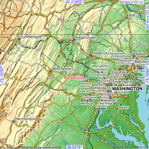
Nearby cities:
Cities around Purcellville sort by population:
• Leesburg elevation 103 m
13.2 km,  100°
100°
• Ashburn 89 m
22.2 km,  117°
117°
• Broadlands 111 m
21.3 km,  128°
128°
• Brambleton 111 m
23 km,  138°
138°
• Brunswick 86 m
21.1 km,  20°
20°
• Belmont 91 m
19.4 km,  114°
114°
• Charles Town 157 m
21 km,  323°
323°
• Ranson 159 m
21.6 km, 324°
• Shannondale 175 m
12 km, 318°
• Lovettsville 154 m
16.5 km, 24°
• Point of Rocks 79 m
21.6 km,  44°
44°
• Bolivar 151 m
21 km,  351°
351°
Multilingual:
 En español:
Purcellville elevación 172 m.
 En France:
Purcellville élévation 172 m.
 Auf Deutsch:
Purcellville höhe über dem Meeresspiegel ist 172 m.

Sources and notes:
- [note 1] Map square and city borders are not equal. Map elevation data is calculated only from area inside that square.
- [src 1] Elevation data from geonames database provided with same terms of usage.
- [src 2] The elevation map of Purcellville is generated using elevation data from NASA's 3 arcsec (90m) resolution SRTM data.
- [src 3] Base (background) map © OpenStreetMap contributors tiles are generated by Geofabrik and OpenTopoMap.
Copyright & License:
This Purcellville Elevation Map is licensed under CC BY-SA. You may reuse any part from this page, if you give a proper credit by linking to this URL:
 More info on terms of use page.