Ashburn elevation
Ashburn (Virginia, Loudoun County), United States elevation is 89 meters and Ashburn elevation in feet is 292 ft above sea level [src 1]. Ashburn is a populated place (feature code) with elevation that is 190 meters (623 ft) smaller than average city elevation in United States.
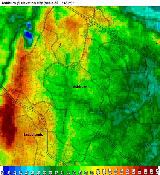
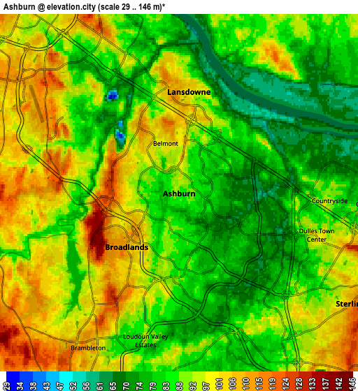
Below is the Elevation map of Ashburn, which displays elevation range with different colors. Scale of the first map is from 35 to 143 m (115 to 469 ft) with average elevation of 88.2 meters (=289 ft) [note 1]
These maps also provides idea of topography and contour of this city, they are displayed at different zoom levels. More info about maps, scale and edge coordinates you can find below images.
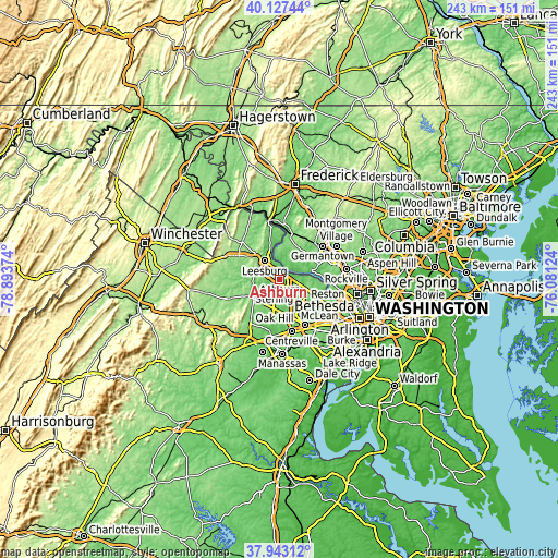
| \ | Map #1 | Map #2 | Topo.Map |
| Scale [m] | 35..143 m | 29..146 m | × |
| Scale [ft] | 115..469 ft | 95..479 ft | × |
| Average | 88.2 m = 289 ft | 89.4 m = 293 ft | × |
| Width | 7.59 km = 4.7 mi | 15.18 km = 9.4 mi | 242.9 km = 150.9 mi |
| Height | 7.59 km = 4.7 mi | 15.18 km = 9.4 mi | 242.9 km = 150.9 mi |
| ↑Max Latitude | 39.077843° | 39.111949° | 40.12744° |
| Latitude at center | 39.04372° | 39.04372° | 39.04372° |
| ↓Min Latitude | 39.009581° | 38.975425° | 37.94312° |
| ← Min Longitude | -77.531435° | -77.575381° | -78.89374° |
| Longitude center | -77.48749° | -77.48749° | -77.48749° |
| →Max Longitude | -77.443545° | -77.399599° | -76.08124° |
Nearby cities:
Cities around Ashburn sort by population:
• Leesburg elevation 103 m
10.4 km,  320°
320°
• Sterling 90 m
6.6 km,  129°
129°
• Broadlands 111 m
4 km,  224°
224°
• Sugarland Run 83 m
9.7 km,  94°
94°
• Lowes Island 54 m
11.8 km,  81°
81°
• Countryside 91 m
6.4 km, 92°
• Brambleton 111 m
8.2 km,  212°
212°
• Belmont 91 m
3 km, 320°
• Dulles Town Center 94 m
6.2 km,  96°
96°
• Loudoun Valley Estates 88 m
7.2 km,  194°
194°
• University Center 78 m
4 km,  68°
68°
• Oak Grove 117 m
9.8 km, 132°
Multilingual:
 En español:
Ashburn elevación 89 m.
 En France:
Ashburn élévation 89 m.


Sources and notes:
- [note 1] Map square and city borders are not equal. Map elevation data is calculated only from area inside that square.
- [src 1] Elevation data from geonames database provided with same terms of usage.
- [src 2] The elevation map of Ashburn is generated using elevation data from NASA's 3 arcsec (90m) resolution SRTM data.
- [src 3] Base (background) map © OpenStreetMap contributors tiles are generated by Geofabrik and OpenTopoMap.
Copyright & License:
This Ashburn Elevation Map is licensed under CC BY-SA. You may reuse any part from this page, if you give a proper credit by linking to this URL:
 More info on terms of use page.