Pearisburg elevation
Pearisburg (Virginia, Giles County), United States elevation is 557 meters and Pearisburg elevation in feet is 1827 ft above sea level [src 1]. Pearisburg is a seat of a second-order administrative division (feature code) with elevation that is 278 meters (912 ft) bigger than average city elevation in United States.
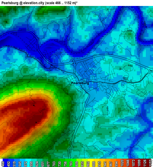
Below is the Elevation map of Pearisburg, which displays elevation range with different colors. Scale of the first map is from 466 to 1152 m (1529 to 3780 ft) with average elevation of 640.3 meters (=2101 ft) [note 1]
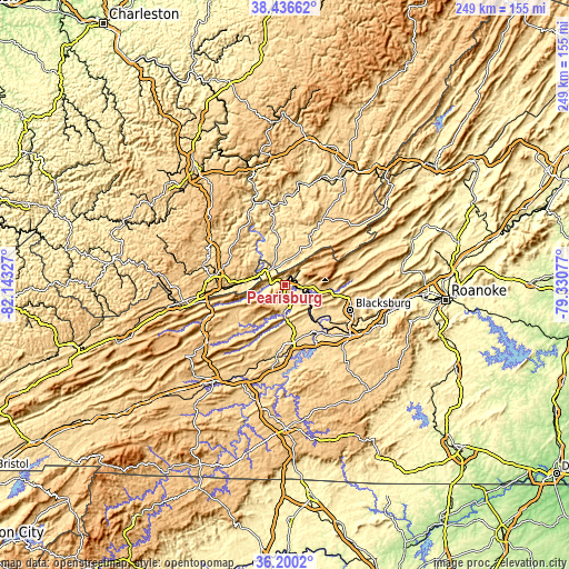
These maps also provides idea of topography and contour of this city, they are displayed at different zoom levels. More info about maps, scale and edge coordinates you can find below images.
| \ | Map #1 | Topo.Map |
| Scale [m] | 466..1152 m | × |
| Scale [ft] | 1529..3780 ft | × |
| Average | 640.3 m = 2101 ft | × |
| Width | 7.77 km = 4.8 mi | 248.7 km = 154.5 mi |
| Height | 7.77 km = 4.8 mi | 248.7 km = 154.5 mi |
| ↑Max Latitude | 37.361667° | 38.43662° |
| Latitude at center | 37.32673° | 37.32673° |
| ↓Min Latitude | 37.291777° | 36.2002° |
| ← Min Longitude | -80.780965° | -82.14327° |
| Longitude center | -80.73702° | -80.73702° |
| →Max Longitude | -80.693075° | -79.33077° |
Nearby cities:
Cities around Pearisburg sort by population:
• Blacksburg elevation 631 m
30.6 km,  110°
110°
• Radford 570 m
25.9 km,  146°
146°
• Pulaski 582 m
31.2 km,  186°
186°
• Princeton 744 m
32.6 km,  277°
277°
• Dublin 632 m
25 km,  169°
169°
• Fairlawn 584 m
24.3 km,  144°
144°
• Merrimac 614 m
31.5 km,  118°
118°
• Narrows 475 m
6.6 km,  274°
274°
• Plum Creek 556 m
30.3 km, 136°
• Pembroke 503 m
8.7 km,  95°
95°
• Prices Fork 619 m
25.4 km, 120°
• Union 631 m
34 km,  30°
30°
Multilingual:
 En español:
Pearisburg elevación 557 m.
 En France:
Pearisburg élévation 557 m.
 Auf Deutsch:
Pearisburg höhe über dem Meeresspiegel ist 557 m.

Sources and notes:
- [note 1] Map square and city borders are not equal. Map elevation data is calculated only from area inside that square.
- [src 1] Elevation data from geonames database provided with same terms of usage.
- [src 2] The elevation map of Pearisburg is generated using elevation data from NASA's 3 arcsec (90m) resolution SRTM data.
- [src 3] Base (background) map © OpenStreetMap contributors tiles are generated by Geofabrik and OpenTopoMap.
Copyright & License:
This Pearisburg Elevation Map is licensed under CC BY-SA. You may reuse any part from this page, if you give a proper credit by linking to this URL:
 More info on terms of use page.