Falls Church elevation
Falls Church (Virginia, City of Falls Church), United States elevation is 104 meters and Falls Church elevation in feet is 341 ft above sea level [src 1]. Falls Church is a seat of a second-order administrative division (feature code) with elevation that is 175 meters (574 ft) smaller than average city elevation in United States.
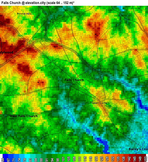
Below is the Elevation map of Falls Church, which displays elevation range with different colors. Scale of the first map is from 64 to 152 m (210 to 499 ft) with average elevation of 105.4 meters (=346 ft) [note 1]
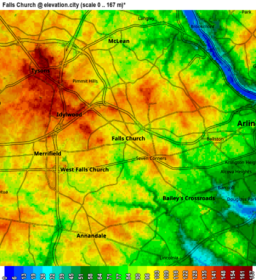
These maps also provides idea of topography and contour of this city, they are displayed at different zoom levels. More info about maps, scale and edge coordinates you can find below images.
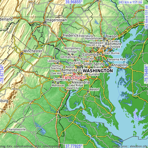
| \ | Map #1 | Map #2 | Topo.Map |
| Scale [m] | 64..152 m | 0..167 m | × |
| Scale [ft] | 210..499 ft | 0..548 ft | × |
| Average | 105.4 m = 346 ft | 94.8 m = 311 ft | × |
| Width | 7.61 km = 4.7 mi | 15.21 km = 9.5 mi | 243.4 km = 151.2 mi |
| Height | 7.61 km = 4.7 mi | 15.21 km = 9.5 mi | 243.4 km = 151.2 mi |
| ↑Max Latitude | 38.91653° | 38.950714° | 39.96855° |
| Latitude at center | 38.88233° | 38.88233° | 38.88233° |
| ↓Min Latitude | 38.848113° | 38.81388° | 37.77925° |
| ← Min Longitude | -77.215035° | -77.258981° | -78.57734° |
| Longitude center | -77.17109° | -77.17109° | -77.17109° |
| →Max Longitude | -77.127145° | -77.083199° | -75.76484° |
Nearby cities:
Cities around Falls Church sort by population:
• Arlington elevation 83 m
5.8 km,  91°
91°
• McLean 91 m
5.8 km,  354°
354°
• Annandale 110 m
6.2 km,  200°
200°
• West Falls Church 104 m
1.5 km,  309°
309°
• Jefferson 106 m
2.4 km,  216°
216°
• Baileys Crossroads 77 m
5 km,  134°
134°
• Idylwood 143 m
3.8 km,  292°
292°
• Merrifield 109 m
4.9 km,  259°
259°
• Lake Barcroft 84 m
4.1 km,  160°
160°
• Seven Corners 119 m
1.8 km, 129°
• Dunn Loring 138 m
4.5 km, 285°
• Pimmit Hills 113 m
4.3 km,  322°
322°
Multilingual:
 En español:
Falls Church elevación 104 m.
 En France:
Falls Church élévation 104 m.
 Auf Deutsch:
Falls Church höhe über dem Meeresspiegel ist 104 m.

Sources and notes:
- [note 1] Map square and city borders are not equal. Map elevation data is calculated only from area inside that square.
- [src 1] Elevation data from geonames database provided with same terms of usage.
- [src 2] The elevation map of Falls Church is generated using elevation data from NASA's 3 arcsec (90m) resolution SRTM data.
- [src 3] Base (background) map © OpenStreetMap contributors tiles are generated by Geofabrik and OpenTopoMap.
Copyright & License:
This Falls Church Elevation Map is licensed under CC BY-SA. You may reuse any part from this page, if you give a proper credit by linking to this URL:
 More info on terms of use page.