Abingdon elevation
Abingdon (Virginia, Washington County), United States elevation is 638 meters and Abingdon elevation in feet is 2093 ft above sea level [src 1]. Abingdon is a seat of a second-order administrative division (feature code) with elevation that is 359 meters (1178 ft) bigger than average city elevation in United States.
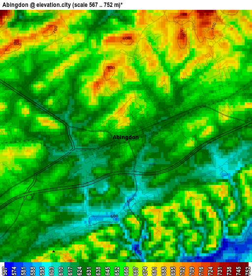
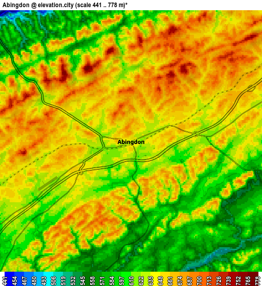
Below is the Elevation map of Abingdon, which displays elevation range with different colors. Scale of the first map is from 567 to 752 m (1860 to 2467 ft) with average elevation of 646.1 meters (=2120 ft) [note 1]
These maps also provides idea of topography and contour of this city, they are displayed at different zoom levels. More info about maps, scale and edge coordinates you can find below images.
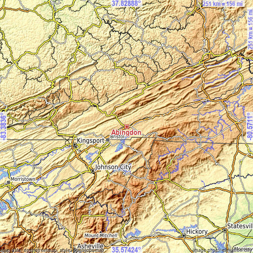
| \ | Map #1 | Map #2 | Topo.Map |
| Scale [m] | 567..752 m | 441..778 m | × |
| Scale [ft] | 1860..2467 ft | 1447..2552 ft | × |
| Average | 646.1 m = 2120 ft | 633.3 m = 2078 ft | × |
| Width | 7.83 km = 4.9 mi | 15.67 km = 9.7 mi | 250.7 km = 155.8 mi |
| Height | 7.83 km = 4.9 mi | 15.67 km = 9.7 mi | 250.7 km = 155.8 mi |
| ↑Max Latitude | 36.745052° | 36.780257° | 37.82888° |
| Latitude at center | 36.70983° | 36.70983° | 36.70983° |
| ↓Min Latitude | 36.674592° | 36.639338° | 35.57424° |
| ← Min Longitude | -82.021295° | -82.065241° | -83.3836° |
| Longitude center | -81.97735° | -81.97735° | -81.97735° |
| →Max Longitude | -81.933405° | -81.889459° | -80.5711° |
Nearby cities:
Cities around Abingdon sort by population:
• Bristol elevation 509 m
22.8 km,  235°
235°
• Bristol 513 m
22.7 km, 236°
• Lebanon 627 m
23.1 km,  336°
336°
• Fairmount 530 m
22.2 km,  231°
231°
• Mountain City 739 m
30.4 km,  149°
149°
• Walnut Hill 489 m
29.4 km, 238°
• Castlewood 491 m
33.6 km,  306°
306°
• Saltville 529 m
27.1 km,  45°
45°
• Chilhowie 592 m
28.1 km,  69°
69°
• Glade Spring 630 m
20.5 km,  63°
63°
• Honaker 581 m
34.1 km,  0°
0°
• Emory 652 m
14.4 km, 60°
Multilingual:
 En español:
Abingdon elevación 638 m.
 En France:
Abingdon élévation 638 m.
 Auf Deutsch:
Abingdon höhe über dem Meeresspiegel ist 638 m.

Sources and notes:
- [note 1] Map square and city borders are not equal. Map elevation data is calculated only from area inside that square.
- [src 1] Elevation data from geonames database provided with same terms of usage.
- [src 2] The elevation map of Abingdon is generated using elevation data from NASA's 3 arcsec (90m) resolution SRTM data.
- [src 3] Base (background) map © OpenStreetMap contributors tiles are generated by Geofabrik and OpenTopoMap.
Copyright & License:
This Abingdon Elevation Map is licensed under CC BY-SA. You may reuse any part from this page, if you give a proper credit by linking to this URL:
 More info on terms of use page.