Southlake elevation
Southlake (Texas, Tarrant County), United States elevation is 197 meters and Southlake elevation in feet is 646 ft above sea level [src 1]. Southlake is a populated place (feature code) with elevation that is 82 meters (269 ft) smaller than average city elevation in United States.
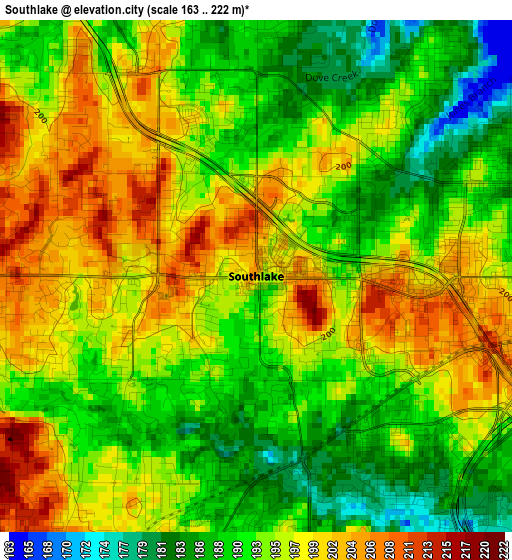
Below is the Elevation map of Southlake, which displays elevation range with different colors. Scale of the first map is from 163 to 222 m (535 to 728 ft) with average elevation of 194.3 meters (=637 ft) [note 1]
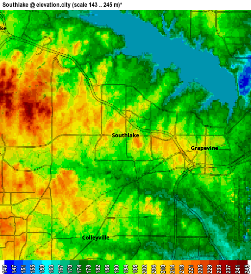
These maps also provides idea of topography and contour of this city, they are displayed at different zoom levels. More info about maps, scale and edge coordinates you can find below images.
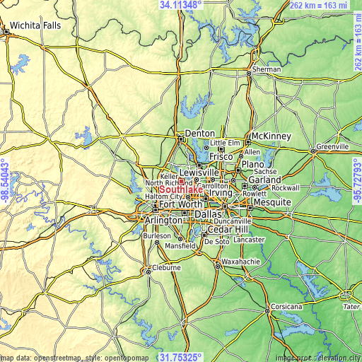
| \ | Map #1 | Map #2 | Topo.Map |
| Scale [m] | 163..222 m | 143..245 m | × |
| Scale [ft] | 535..728 ft | 469..804 ft | × |
| Average | 194.3 m = 637 ft | 190.9 m = 626 ft | × |
| Width | 8.2 km = 5.1 mi | 16.4 km = 10.2 mi | 262.4 km = 163 mi |
| Height | 8.2 km = 5.1 mi | 16.4 km = 10.2 mi | 262.4 km = 163 mi |
| ↑Max Latitude | 32.978112° | 33.01497° | 34.11348° |
| Latitude at center | 32.94124° | 32.94124° | 32.94124° |
| ↓Min Latitude | 32.904352° | 32.867449° | 31.75325° |
| ← Min Longitude | -97.178125° | -97.222071° | -98.54043° |
| Longitude center | -97.13418° | -97.13418° | -97.13418° |
| →Max Longitude | -97.090235° | -97.046289° | -95.72793° |
Nearby cities:
Cities around Southlake sort by population:
• Flower Mound elevation 186 m
8.9 km,  23°
23°
• Euless 184 m
12.6 km,  157°
157°
• Grapevine 199 m
5.3 km,  98°
98°
• Bedford 187 m
10.8 km,  184°
184°
• Keller 220 m
11 km,  266°
266°
• Coppell 169 m
11.2 km,  82°
82°
• Hurst 174 m
13.5 km,  194°
194°
• Colleyville 190 m
7 km,  196°
196°
• Trophy Club 190 m
7.8 km,  323°
323°
• Roanoke 198 m
11 km,  309°
309°
• Double Oak 204 m
13.9 km,  9°
9°
• Westlake 206 m
7.9 km, 314°
Multilingual:
 En español:
Southlake elevación 197 m.
 En France:
Southlake élévation 197 m.
 Auf Deutsch:
Southlake höhe über dem Meeresspiegel ist 197 m.

Sources and notes:
- [note 1] Map square and city borders are not equal. Map elevation data is calculated only from area inside that square.
- [src 1] Elevation data from geonames database provided with same terms of usage.
- [src 2] The elevation map of Southlake is generated using elevation data from NASA's 3 arcsec (90m) resolution SRTM data.
- [src 3] Base (background) map © OpenStreetMap contributors tiles are generated by Geofabrik and OpenTopoMap.
Copyright & License:
This Southlake Elevation Map is licensed under CC BY-SA. You may reuse any part from this page, if you give a proper credit by linking to this URL:
 More info on terms of use page.