Navasota elevation
Navasota (Texas, Grimes County), United States elevation is 70 meters and Navasota elevation in feet is 230 ft above sea level [src 1]. Navasota is a populated place (feature code) with elevation that is 209 meters (686 ft) smaller than average city elevation in United States.
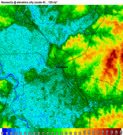
Below is the Elevation map of Navasota, which displays elevation range with different colors. Scale of the first map is from 52 to 109 m (171 to 358 ft) with average elevation of 73 meters (=240 ft) [note 1]
These maps also provides idea of topography and contour of this city, they are displayed at different zoom levels. More info about maps, scale and edge coordinates you can find below images.

| \ | Map #1 | Map #2 | Topo.Map |
| Scale [m] | 52..109 m | 43..129 m | × |
| Scale [ft] | 171..358 ft | 141..423 ft | × |
| Average | 73 m = 240 ft | 73.5 m = 241 ft | × |
| Width | 8.43 km = 5.2 mi | 16.86 km = 10.5 mi | 269.7 km = 167.6 mi |
| Height | 8.43 km = 5.2 mi | 16.86 km = 10.5 mi | 269.8 km = 167.6 mi |
| ↑Max Latitude | 30.425881° | 30.463767° | 31.59345° |
| Latitude at center | 30.38798° | 30.38798° | 30.38798° |
| ↓Min Latitude | 30.350065° | 30.312134° | 29.16745° |
| ← Min Longitude | -96.131675° | -96.175621° | -97.49398° |
| Longitude center | -96.08773° | -96.08773° | -96.08773° |
| →Max Longitude | -96.043785° | -95.999839° | -94.68148° |
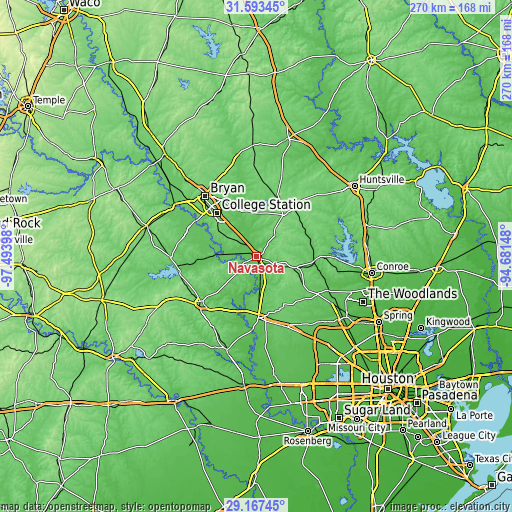
Nearby cities:
Cities around Navasota sort by population:
• College Station elevation 107 m
35.6 km,  318°
318°
• Bryan 116 m
41.8 km, 319°
• Brenham 109 m
38.6 km,  230°
230°
• Hempstead 77 m
32.3 km,  178°
178°
• Prairie View 91 m
34.1 km,  163°
163°
• Pinehurst 69 m
45.8 km,  121°
121°
• Bellville 92 m
51.3 km,  198°
198°
• Waller 77 m
40 km, 157°
• Magnolia 84 m
38 km, 121°
• Somerville 77 m
42.5 km,  263°
263°
• Pine Island 65 m
37 km,  172°
172°
• Anderson 110 m
14.7 km,  41°
41°
Multilingual:
 En español:
Navasota elevación 70 m.
 En France:
Navasota élévation 70 m.


Sources and notes:
- [note 1] Map square and city borders are not equal. Map elevation data is calculated only from area inside that square.
- [src 1] Elevation data from geonames database provided with same terms of usage.
- [src 2] The elevation map of Navasota is generated using elevation data from NASA's 3 arcsec (90m) resolution SRTM data.
- [src 3] Base (background) map © OpenStreetMap contributors tiles are generated by Geofabrik and OpenTopoMap.
Copyright & License:
This Navasota Elevation Map is licensed under CC BY-SA. You may reuse any part from this page, if you give a proper credit by linking to this URL:
 More info on terms of use page.