Waller elevation
Waller (Texas, Waller County), United States elevation is 77 meters and Waller elevation in feet is 253 ft above sea level [src 1]. Waller is a populated place (feature code) with elevation that is 202 meters (663 ft) smaller than average city elevation in United States.
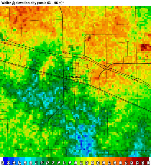
Below is the Elevation map of Waller, which displays elevation range with different colors. Scale of the first map is from 63 to 96 m (207 to 315 ft) with average elevation of 79.7 meters (=261 ft) [note 1]
These maps also provides idea of topography and contour of this city, they are displayed at different zoom levels. More info about maps, scale and edge coordinates you can find below images.
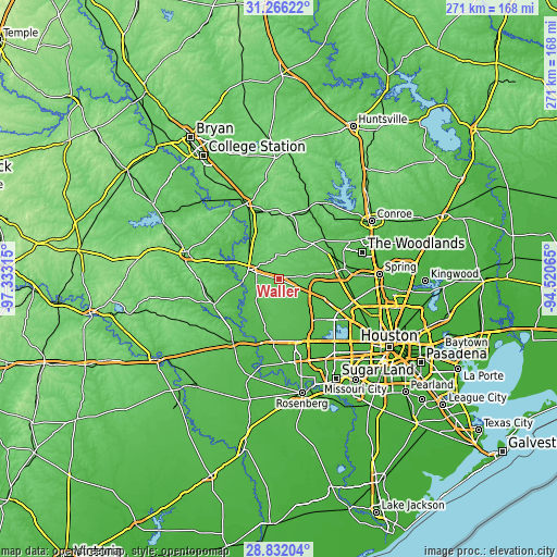
| \ | Map #1 | Topo.Map |
| Scale [m] | 63..96 m | × |
| Scale [ft] | 207..315 ft | × |
| Average | 79.7 m = 261 ft | × |
| Width | 8.46 km = 5.3 mi | 270.7 km = 168.2 mi |
| Height | 8.46 km = 5.3 mi | 270.7 km = 168.2 mi |
| ↑Max Latitude | 30.094639° | 31.26622° |
| Latitude at center | 30.05661° | 30.05661° |
| ↓Min Latitude | 30.018567° | 28.83204° |
| ← Min Longitude | -95.970845° | -97.33315° |
| Longitude center | -95.9269° | -95.9269° |
| →Max Longitude | -95.882955° | -94.52065° |
Nearby cities:
Cities around Waller sort by population:
• Cypress elevation 51 m
24.2 km,  113°
113°
• Katy 44 m
31.7 km,  161°
161°
• Tomball 59 m
30.2 km,  81°
81°
• Hempstead 77 m
15.3 km,  287°
287°
• Sealy 64 m
37.9 km,  215°
215°
• Prairie View 91 m
7.1 km,  304°
304°
• Brookshire 54 m
30.2 km,  184°
184°
• Pinehurst 69 m
26.7 km,  61°
61°
• Bellville 92 m
33.9 km,  249°
249°
• Magnolia 84 m
24 km,  44°
44°
• Oak Cliff Place 41 m
32.3 km,  116°
116°
• Pine Island 65 m
10.6 km,  270°
270°
Multilingual:
 En español:
Waller elevación 77 m.
 En France:
Waller élévation 77 m.


Sources and notes:
- [note 1] Map square and city borders are not equal. Map elevation data is calculated only from area inside that square.
- [src 1] Elevation data from geonames database provided with same terms of usage.
- [src 2] The elevation map of Waller is generated using elevation data from NASA's 3 arcsec (90m) resolution SRTM data.
- [src 3] Base (background) map © OpenStreetMap contributors tiles are generated by Geofabrik and OpenTopoMap.
Copyright & License:
This Waller Elevation Map is licensed under CC BY-SA. You may reuse any part from this page, if you give a proper credit by linking to this URL:
 More info on terms of use page.