Cotulla elevation
Cotulla (Texas, La Salle County), United States elevation is 133 meters and Cotulla elevation in feet is 436 ft above sea level [src 1]. Cotulla is a seat of a second-order administrative division (feature code) with elevation that is 146 meters (479 ft) smaller than average city elevation in United States.
Below is the Elevation map of Cotulla, which displays elevation range with different colors. Scale of the first map is from 110 to 157 m (361 to 515 ft) with average elevation of 131.2 meters (=430 ft) [note 1]
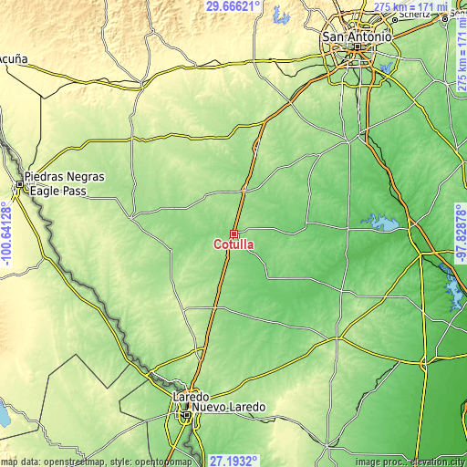
These maps also provides idea of topography and contour of this city, they are displayed at different zoom levels. More info about maps, scale and edge coordinates you can find below images.
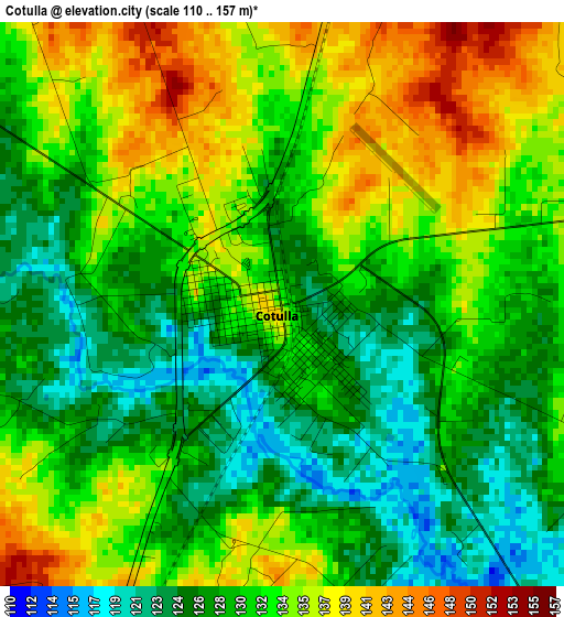
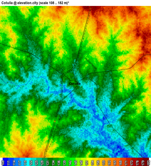
| \ | Map #1 | Map #2 | Topo.Map |
| Scale [m] | 110..157 m | 108..182 m | × |
| Scale [ft] | 361..515 ft | 354..597 ft | × |
| Average | 131.2 m = 430 ft | 139.8 m = 459 ft | × |
| Width | 8.59 km = 5.3 mi | 17.19 km = 10.7 mi | 275 km = 170.9 mi |
| Height | 8.59 km = 5.3 mi | 17.19 km = 10.7 mi | 275 km = 170.9 mi |
| ↑Max Latitude | 28.475566° | 28.514188° | 29.66621° |
| Latitude at center | 28.43693° | 28.43693° | 28.43693° |
| ↓Min Latitude | 28.39828° | 28.359616° | 27.1932° |
| ← Min Longitude | -99.278975° | -99.322921° | -100.64128° |
| Longitude center | -99.23503° | -99.23503° | -99.23503° |
| →Max Longitude | -99.191085° | -99.147139° | -97.82878° |
Nearby cities:
Cities around Cotulla sort by population:
• Pearsall elevation 193 m
52.4 km,  15°
15°
• Crystal City 171 m
63.8 km,  294°
294°
• Carrizo Springs 184 m
61.9 km,  278°
278°
• Devine 200 m
84.5 km, 22°
• Dilley 169 m
26.4 km,  13°
13°
• Cactus 179 m
61 km,  194°
194°
• Charlotte 167 m
70 km,  47°
47°
• La Pryor 228 m
82.1 km,  313°
313°
• Gardendale 177 m
9.1 km, 11°
• Asherton 165 m
51.4 km,  270°
270°
• Batesville 219 m
68.3 km,  326°
326°
• Tilden 79 m
67.1 km,  87°
87°
Multilingual:
 En español:
Cotulla elevación 133 m.
 En France:
Cotulla élévation 133 m.


Sources and notes:
- [note 1] Map square and city borders are not equal. Map elevation data is calculated only from area inside that square.
- [src 1] Elevation data from geonames database provided with same terms of usage.
- [src 2] The elevation map of Cotulla is generated using elevation data from NASA's 3 arcsec (90m) resolution SRTM data.
- [src 3] Base (background) map © OpenStreetMap contributors tiles are generated by Geofabrik and OpenTopoMap.
Copyright & License:
This Cotulla Elevation Map is licensed under CC BY-SA. You may reuse any part from this page, if you give a proper credit by linking to this URL:
 More info on terms of use page.