Carrizo Springs elevation
Carrizo Springs (Texas, Dimmit County), United States elevation is 184 meters and Carrizo Springs elevation in feet is 604 ft above sea level [src 1]. Carrizo Springs is a seat of a second-order administrative division (feature code) with elevation that is 95 meters (312 ft) smaller than average city elevation in United States.
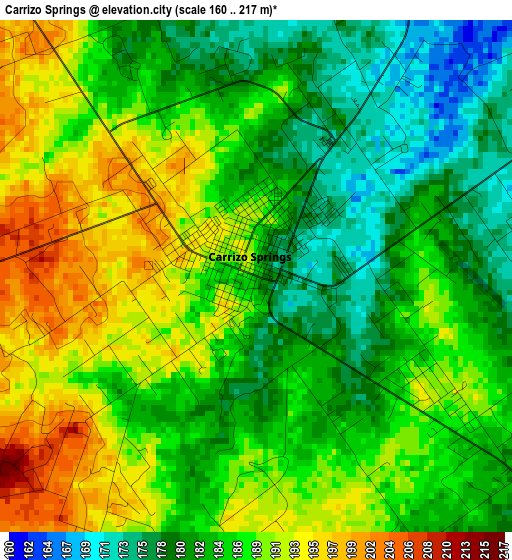
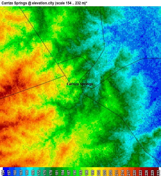
Below is the Elevation map of Carrizo Springs, which displays elevation range with different colors. Scale of the first map is from 160 to 217 m (525 to 712 ft) with average elevation of 185.8 meters (=610 ft) [note 1]
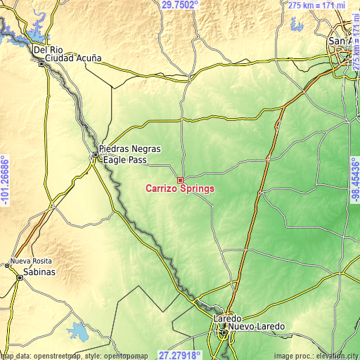
These maps also provides idea of topography and contour of this city, they are displayed at different zoom levels. More info about maps, scale and edge coordinates you can find below images.
| \ | Map #1 | Map #2 | Topo.Map |
| Scale [m] | 160..217 m | 154..232 m | × |
| Scale [ft] | 525..712 ft | 505..761 ft | × |
| Average | 185.8 m = 610 ft | 185.6 m = 609 ft | × |
| Width | 8.59 km = 5.3 mi | 17.17 km = 10.7 mi | 274.8 km = 170.8 mi |
| Height | 8.59 km = 5.3 mi | 17.17 km = 10.7 mi | 274.8 km = 170.8 mi |
| ↑Max Latitude | 28.560535° | 28.599125° | 29.7502° |
| Latitude at center | 28.52193° | 28.52193° | 28.52193° |
| ↓Min Latitude | 28.483311° | 28.444678° | 27.27918° |
| ← Min Longitude | -99.904555° | -99.948501° | -101.26686° |
| Longitude center | -99.86061° | -99.86061° | -99.86061° |
| →Max Longitude | -99.816665° | -99.772719° | -98.45436° |
Nearby cities:
Cities around Carrizo Springs sort by population:
• Eagle Pass elevation 226 m
65.7 km,  288°
288°
• Eidson Road 227 m
63.5 km, 285°
• Crystal City 171 m
17.6 km,  10°
10°
• Cotulla 133 m
61.9 km,  98°
98°
• Rosita North 240 m
56.8 km, 285°
• Las Quintas Fronterizas Colonia 228 m
62.3 km, 287°
• Las Quintas Fronterizas 229 m
62.2 km, 287°
• Rosita South 224 m
56.6 km,  281°
281°
• La Pryor 228 m
46.6 km,  1°
1°
• Gardendale 177 m
63 km,  90°
90°
• Asherton 165 m
13.2 km,  132°
132°
• Batesville 219 m
53.3 km,  26°
26°
Multilingual:
 En español:
Carrizo Springs elevación 184 m.
 En France:
Carrizo Springs élévation 184 m.
 Auf Deutsch:
Carrizo Springs höhe über dem Meeresspiegel ist 184 m.

Sources and notes:
- [note 1] Map square and city borders are not equal. Map elevation data is calculated only from area inside that square.
- [src 1] Elevation data from geonames database provided with same terms of usage.
- [src 2] The elevation map of Carrizo Springs is generated using elevation data from NASA's 3 arcsec (90m) resolution SRTM data.
- [src 3] Base (background) map © OpenStreetMap contributors tiles are generated by Geofabrik and OpenTopoMap.
Copyright & License:
This Carrizo Springs Elevation Map is licensed under CC BY-SA. You may reuse any part from this page, if you give a proper credit by linking to this URL:
 More info on terms of use page.