Atlanta elevation
Atlanta (Texas, Cass County), United States elevation is 83 meters and Atlanta elevation in feet is 272 ft above sea level [src 1]. Atlanta is a populated place (feature code) with elevation that is 196 meters (643 ft) smaller than average city elevation in United States.
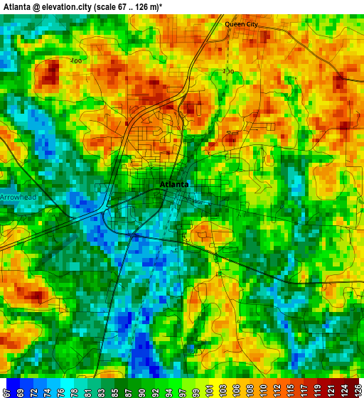
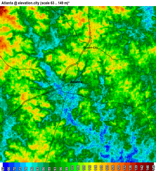
Below is the Elevation map of Atlanta, which displays elevation range with different colors. Scale of the first map is from 67 to 126 m (220 to 413 ft) with average elevation of 94.9 meters (=311 ft) [note 1]
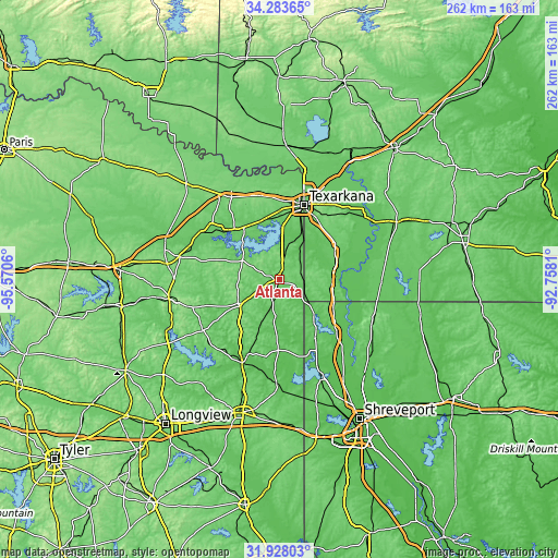
These maps also provides idea of topography and contour of this city, they are displayed at different zoom levels. More info about maps, scale and edge coordinates you can find below images.
| \ | Map #1 | Map #2 | Topo.Map |
| Scale [m] | 67..126 m | 63..149 m | × |
| Scale [ft] | 220..413 ft | 207..489 ft | × |
| Average | 94.9 m = 311 ft | 96.7 m = 317 ft | × |
| Width | 8.19 km = 5.1 mi | 16.37 km = 10.2 mi | 261.9 km = 162.7 mi |
| Height | 8.19 km = 5.1 mi | 16.37 km = 10.2 mi | 261.9 km = 162.7 mi |
| ↑Max Latitude | 33.15054° | 33.187325° | 34.28365° |
| Latitude at center | 33.11374° | 33.11374° | 33.11374° |
| ↓Min Latitude | 33.076924° | 33.040093° | 31.92803° |
| ← Min Longitude | -94.208295° | -94.252241° | -95.5706° |
| Longitude center | -94.16435° | -94.16435° | -94.16435° |
| →Max Longitude | -94.120405° | -94.076459° | -92.7581° |
Nearby cities:
Cities around Atlanta sort by population:
• Texarkana elevation 95 m
36.3 km,  17°
17°
• Texarkana 118 m
38.3 km, 17°
• Wake Village 106 m
35.2 km,  8°
8°
• Vivian 81 m
31.6 km,  148°
148°
• Nash 112 m
36.7 km,  4°
4°
• Hooks 116 m
40.9 km,  343°
343°
• Jefferson 63 m
43.1 km,  203°
203°
• Linden 119 m
21.9 km,  238°
238°
• Queen City 112 m
4.1 km, 18°
• Maud 93 m
29.5 km,  325°
325°
• Redwater 94 m
28.4 km, 342°
• Red Lick 113 m
39 km,  359°
359°
Multilingual:
 En español:
Atlanta elevación 83 m.
 En France:
Atlanta élévation 83 m.


Sources and notes:
- [note 1] Map square and city borders are not equal. Map elevation data is calculated only from area inside that square.
- [src 1] Elevation data from geonames database provided with same terms of usage.
- [src 2] The elevation map of Atlanta is generated using elevation data from NASA's 3 arcsec (90m) resolution SRTM data.
- [src 3] Base (background) map © OpenStreetMap contributors tiles are generated by Geofabrik and OpenTopoMap.
Copyright & License:
This Atlanta Elevation Map is licensed under CC BY-SA. You may reuse any part from this page, if you give a proper credit by linking to this URL:
 More info on terms of use page.